The Tweed Local Government Area (LGA) is located in the Northern Rivers area of New South Wales. The main river system is the Tweed River, with two main tributaries that flow into it; the Oxley and Rous Rivers. The Tweed River system also includes the Cobaki and Terranora Broadwaters.
In addition to the main river system there is a smaller Tweed Coastal Creeks system that is completely separate to the Tweed River system. These coastal creeks affect the communities of Burringbar, Mooball, Crabbes Creek and the coastal villages of Kingscliff, Cabarita Beach/Bogangar, Hastings Point and Pottsville.
Knowing the flood potential of where you live, work and visit in the Tweed Shire is important to keeping yourself, your family and others safe during floods.
See below to find out more about floods in your area, and steps you can take before, during and after flooding.
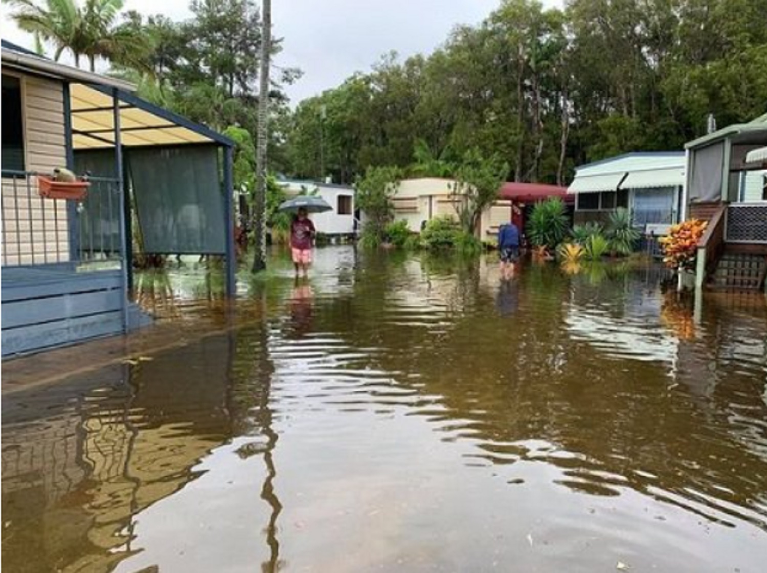
Yes you are! Low lying areas of Tweed Heads South and Banora Point are definitely at risk from floods.
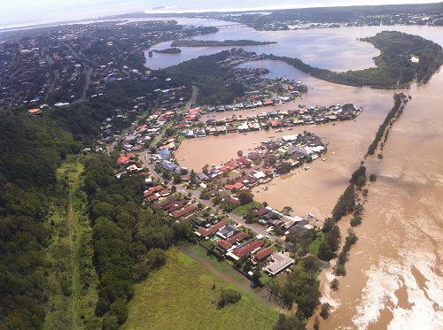
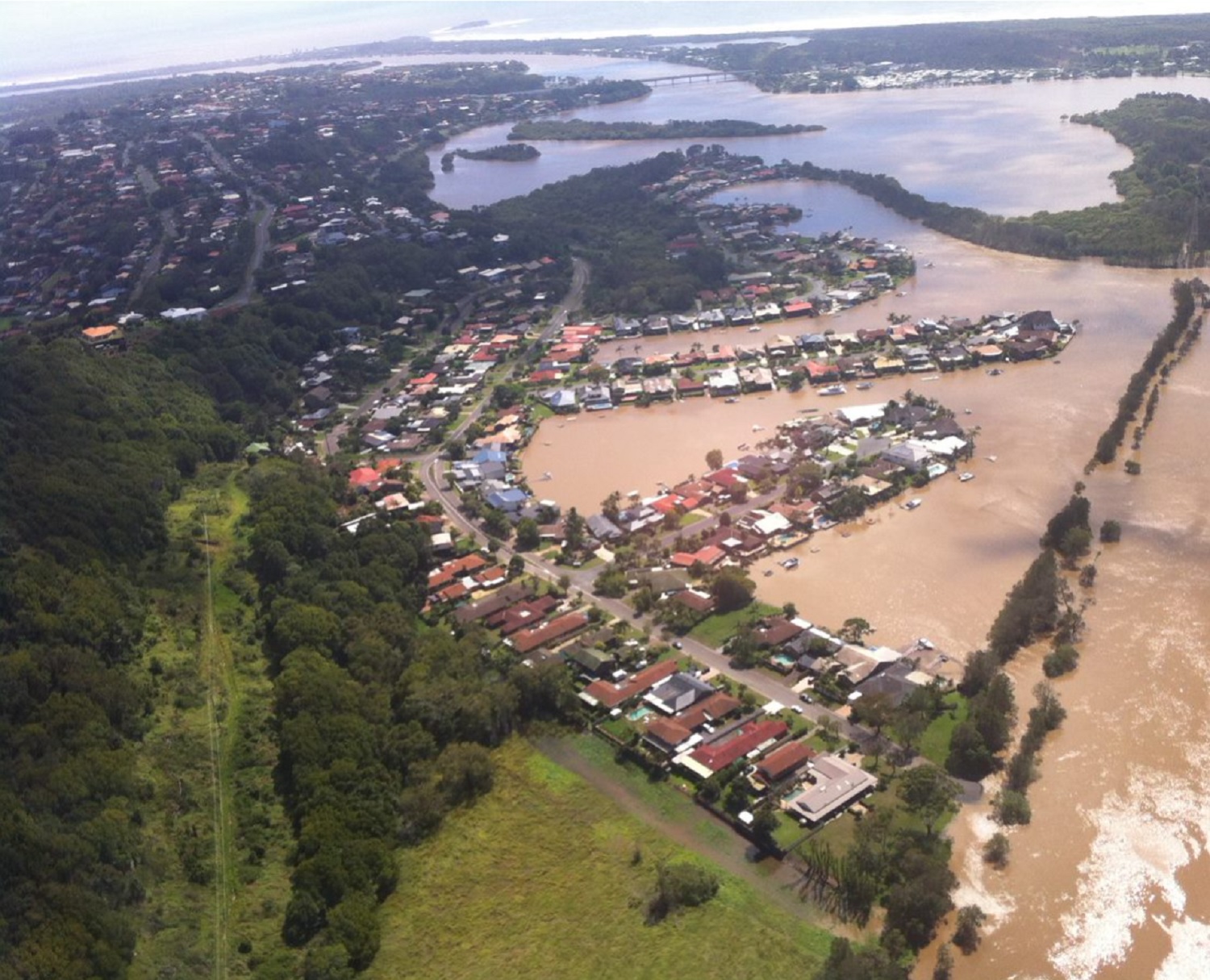
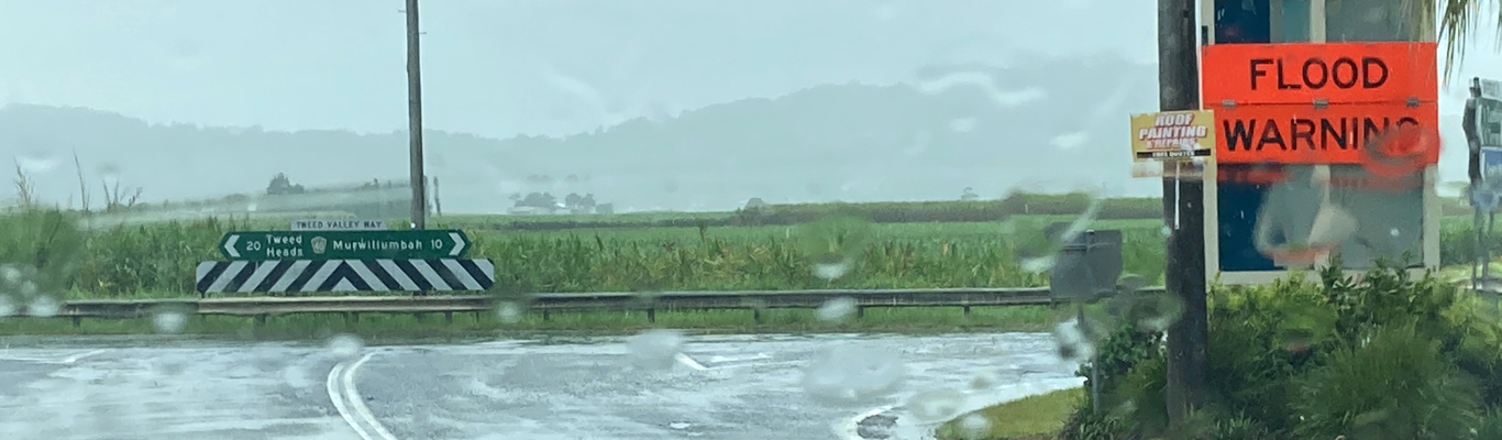
Every year the Tweed area is affected by severe weather events which usually cause flooding in the local area. Over the years, significant floods have occured in 1954, 1974 and 2017. Modelling has shown that floods well in excess of these levels are possible.
Flooding in the Banora Point and Tweed Heads South area can occur due to either runoff from the local catchments or by backwater flows from Terranora Broadwater or the Tweed River.
High river levels, storm surge and tidal influences can prevent storm water from draining and may result in roads being flooded. Steep urban development towards Terranora makes these areas susceptible to local flash flooding.
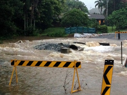
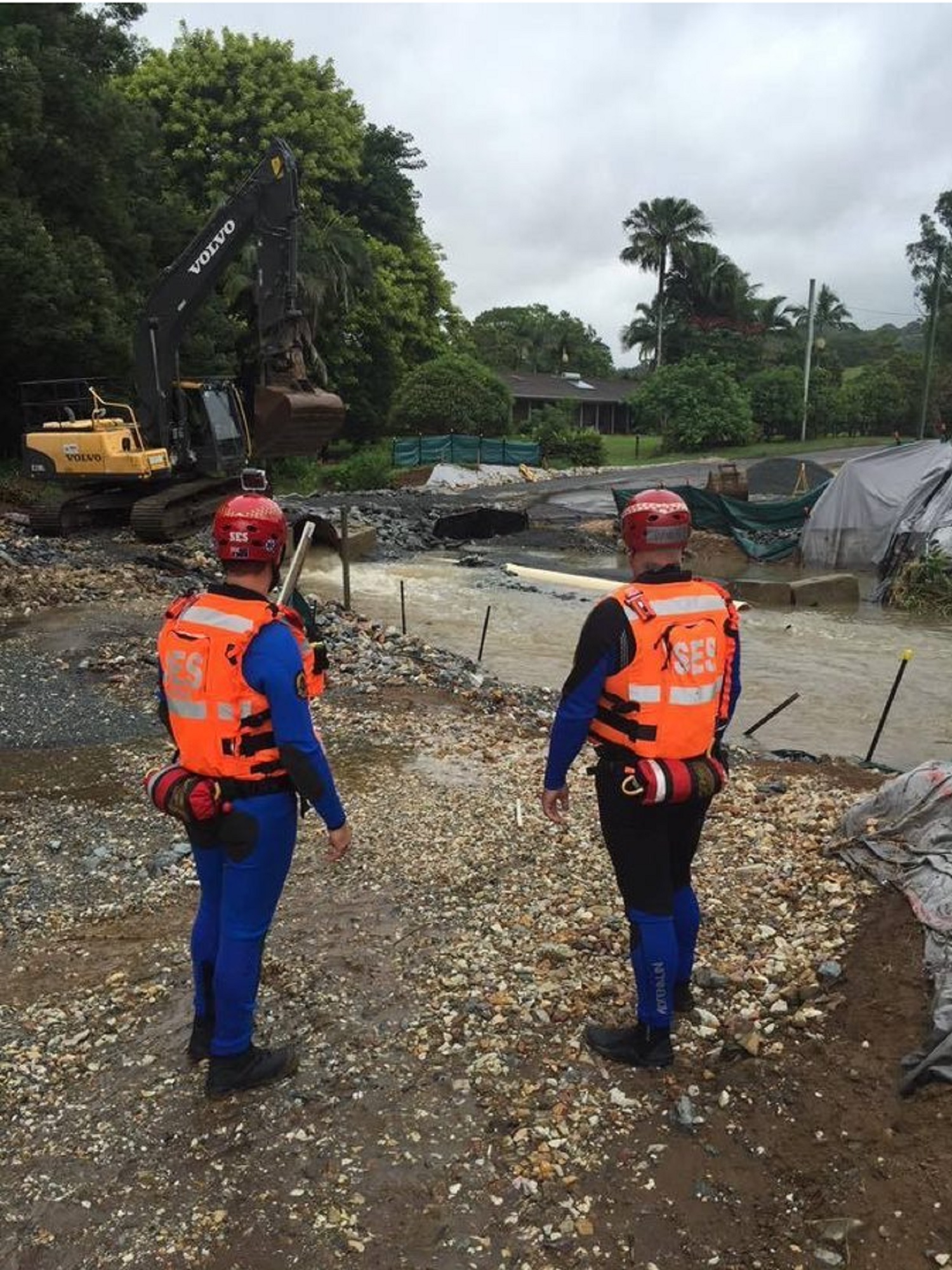
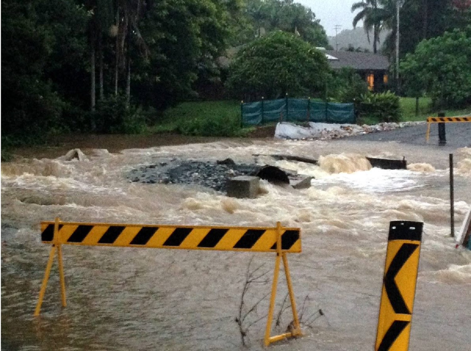
In June 2005, a low pressure system stalled over the Qld border causing torrential rain and flash flooding to the whole Tweed area. Tweed Heads recorded 386mm rain in a 24 hour period. Flash flooding caused water to enter homes, road closures, landslides, power and communications outages. Coolangatta Airport had to close due to flooding on parts of the tarmac.
While this event caused some river rises, the real damage in the Tweed Heads South and Banora Point area was caused by flash flooding.
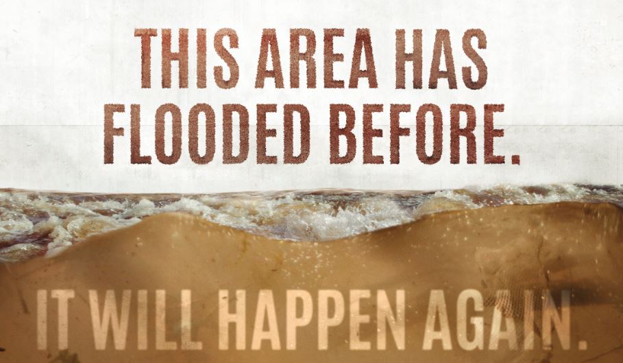
Tweed Heads South and Banora Point will flood again. That’s a fact!
To understand what happens in a Tweed South and Banora Point flood, it is important that all residents and businesses know:
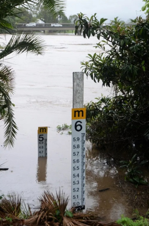
The Chinderah (Barney's Point) Gauge, is the guide for riverine flood levels that impact the Tweed South and Banora Point area.
Please click on the Tweed Heads South and Banora Point FloodSafe Guide for information about the Chinderah (Barney's Point) Gauge and what consequences occur at different flood heights.
Yes you are!
Tweed Heads West, Cobaki and Seagulls Estate are suburbs located in the Tweed Shire in the northeast corner of NSW. All three suburbs have low-lying areas that experience either nuisance minor flooding or moderate to major flooding. Over the years, significant floods have occurred in 1954, 1974 and 2017. Floods well in excess of these levels are possible.
Tweed Heads West and Cobaki
Flooding occurs on Bilambil and Terranora Creeks which feed into the Tweed River and affects many areas in Tweed Heads West. Cobaki Creek can also flood, causing this area to be isolated. Flooding can occur from riverine flooding (made worse by high tides and storm surge) or intensive localized flash flooding from heavy rainfall which may cause local streets and roads to close as seen in 2005
In a major flood, low-lying areas of Tweed Heads West will become flood islands and isolated for significant periods. Some residents and businesses, including retirement homes and aged care facilities will require evacuation. Most properties along Kennedy Drive, Gray Street, Rose Street, Blue Waters Crescent and Wyuna Road will be affected by floodwater.
Seagulls Estate
Approximately 2/3 of Seagulls Estate and all the streets are inundated in a major flood, with depths up to 1.5 metres along Sunset Boulevard.
In the event of intensive localized flash flooding influenced by Cobaki, Piggabeen and Bilambil Creeks, the evacuation time is 3 to 4 hours.
To understand what happens in a Tweed West, Cobaki and Seagulls Estate flood, it is important that all residents and businesses know:
The Chinderah (Barney's Point) Gauge, is the guide for riverine flood levels that impact the Tweed West, Cobaki and Seagulls Estate area.
Please click on the Tweed Heads West, Cobaki and Seagulls Estate FloodSafe Guide for information about the Chinderah (Barney's Point) Gauge and what consequences occur at different flood heights.
Yes you are!
Chinderah and Fingal Head have a long history of flooding. Every year, severe weather such as low-pressure systems, cyclones or ex tropical cyclones affect the area causing either minor nuisance flooding up to moderate or major flood events.
Significant flooding has occurred in 1954, 1974 and 2017. Flood modelling shows that higher flood levels are possible than what was seen in these years.
Riverine flooding is the main cause of the flooding in Chinderah and Fingal Head. This flooding can be held up from escaping the river mouth by high tides and storm surges.
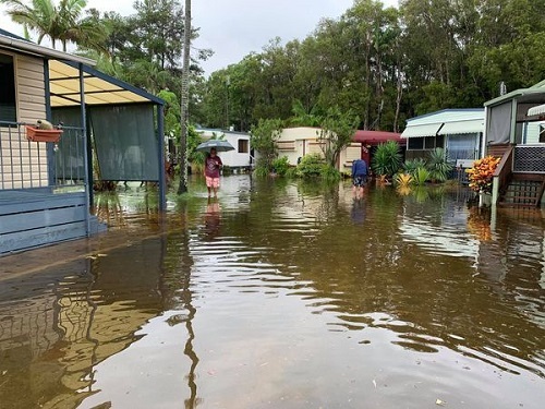
In a major flood, low-lying areas of Chinderah and Fingal will become isolated, with some properties experiencing over floor flooding. Some residents and businesses, including several caravan parks will require evacuation.
Flash flooding and overflow from stormwater drains also contribute to flooding in the area. In June 2005, a low pressure system stalled over the Qld border causing torrential rain and flash flooding to the whole Tweed area causing road closures, power and communication outages and inundations.
Chinderah and Fingal Head will flood again. That's a fact!
To understand what happens in a Chinderah and Fingal Head flood, it is important that all residents and businesses know:
The Chinderah (Barney's Point) Gauge, is the guide for riverine flood levels that impact the Chinderah and Fingal Head flood area.
Please click on the Chinderah and Fingal Head FloodSafe Guide for information about the Chinderah (Barney's Point) Gauge and what consequences occur at different flood heights.
Yes you are!
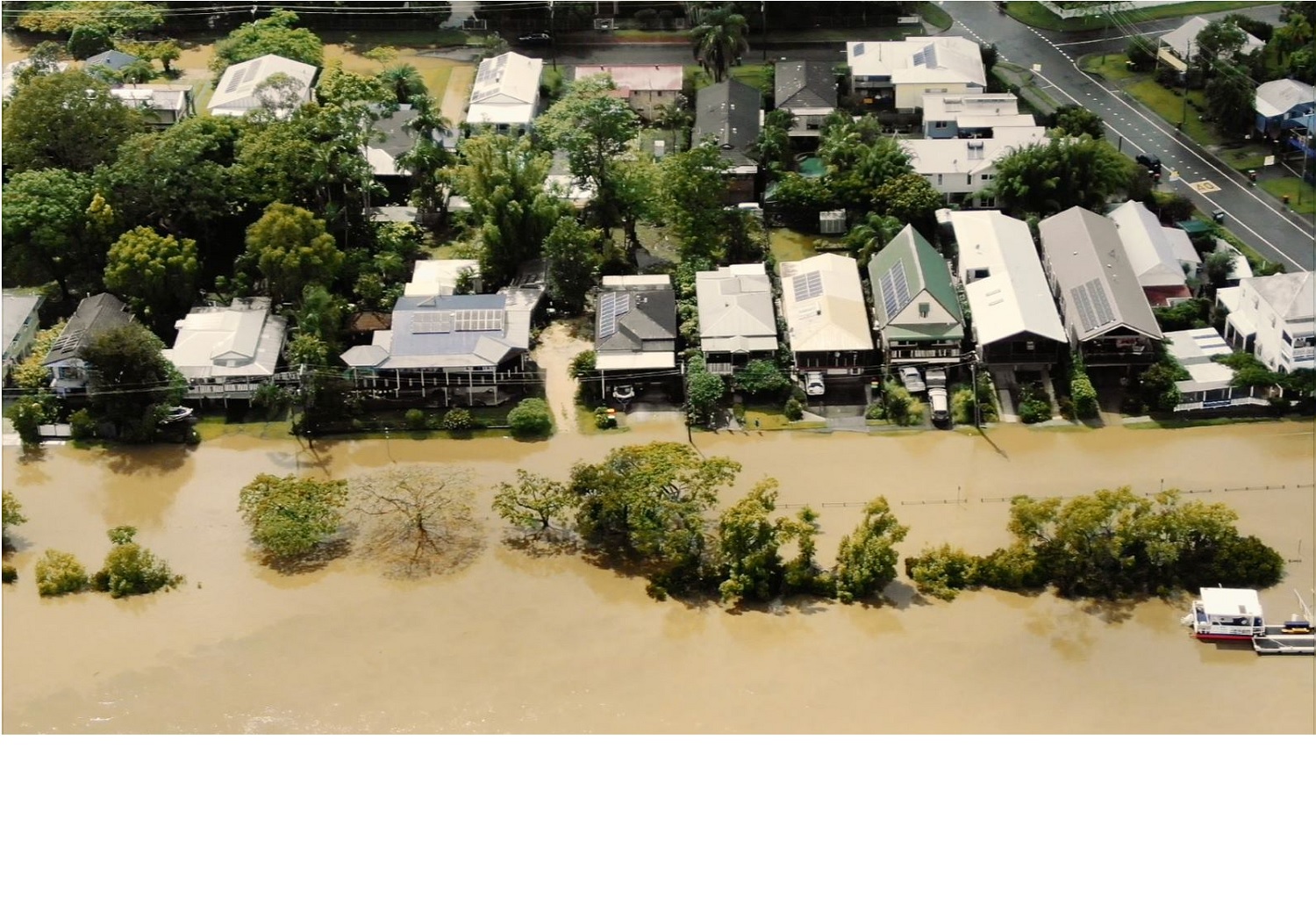
Murwillumbah is a regional town located in the Tweed Valley in Northern NSW. It is situated close to the QLD border. The area is subject to severe weather such as low-pressure systems and cyclones which result in heavy rains and flooding.
Murwillumbah has a long history of regular flooding. In March 2017, Murwillumbah and surrounds experienced a “flood of record” with extensive and destructive flooding from ex Tropical Cyclone Debbie. Significant flooding occurred in 1954 (pre levee), 1974, 1989, 2001 and 2008.
The location and geography of the Tweed Valley contributes to flooding in Murwillumbah area. The Caldera means that any rainfall in the upper catchment gets funneled into the three main river systems that affect the Tweed Valley. These include the Oxley River, Rous River and the Tweed River. Murwillumbah is affected by flooding when the Oxley River merges with Tweed River at Byangum.
The Murwillumbah CBD is affected by flooding from:
Residents and businesses in the Murwillumbah CBD and residential areas, including East Murwillumbah need to know their risk. Floods well in excess of the levels reached in 2017 are possible.
Murwillumbah will flood again. That’s a fact!
To understand what happens in a Murwillumbah flood, it is important that all residents and businesses know:
The Murwillumbah Gauge, located on the riverbank near the Tweed Council Chambers, is the guide for riverine flood levels that impact the Murwillumbah and South Murwillumbah area.
Please click on the Murwillumbah FloodSafe Guide for information about the Murwillumbah Gauge and what consequences occur at different flood heights.
Please click on the South Murwillumbah FloodSafe Guide for local information related to different river heights.
Yes you are!
South Murwillumbah, the entry to Murwillumbah township and the CBD, is located in the Tweed Valley in Northern NSW, 30km from the QLD border. The area is subject to severe weather such as
low-pressure systems and cyclones which result in heavy rains and flooding.
South Murwillumbah has a long history of regular flooding with several major floods affecting the area in 1954 (pre-levee), 1974 1989, 2001 and 2008. The 2017 flood was a “flood of record” with many South Murwillumbah properties and businesses experiencing over floor flooding.
A levee was built in South Murwillumbah to protect properties and businesses during most floods; however, this levee can still be overtopped when major flooding occurs.
When the levee overtops, water flows through South Murwillumbah from Greenhills through the industrial estates to Condong. This can cause significant flooding and damage to the industrial areas.
Residents and businesses in South Murwillumbah should be aware that floods well in excess of the levels reached in 2017 are possible and have potential to cause devastating impacts.
South Murwillumbah will flood again. That’s a fact!
To understand what happens in a Murwillumbah flood, it is important that all residents and businesses know:
The Murwillumbah Gauge, located on the riverbank near the Tweed Council Chambers, is the guide for riverine flood levels that impact the Murwillumbah and South Murwillumbah area.
Please click on the Murwillumbah FloodSafe Guide for information about the Murwillumbah Gauge and what consequences occur at different flood heights.
Please click on the South Murwillumbah FloodSafe Guide for local information related to different river heights.
Yes you are!
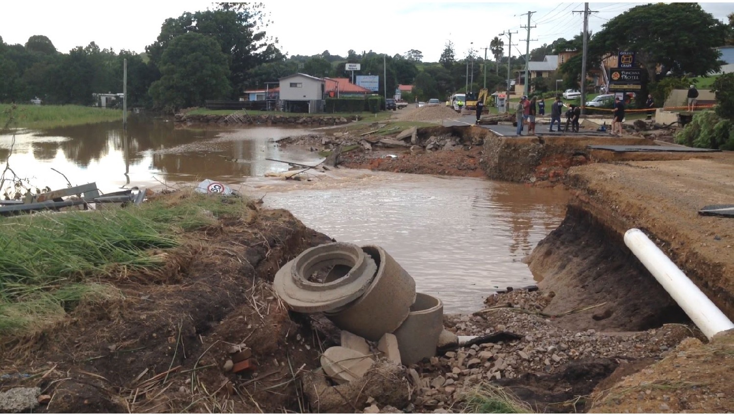
Tumbulgum has a long history of regular flooding with several major floods affecting the area over the years. In March 2017, Tumbulgum experienced extensive flooding from ex Tropical Cyclone Debbie. This was a “flood of record” in Tumbulgum.
The geographic location of the village is a key factor that causes flooding from two directions. The Tumbulgum village is located at the junction of the Tweed and Rous Rivers and on the eastern side is surrounded by low lying cane fields.
Initial inundation through heavy rainfall during severe weather events may cause the cane drains behind the village to overflow into Irving Street and progressively into Bawden Street. This often occurs PRIOR to the river breaking its banks onto Riverside Drive.
In addition major flooding can cause the river to break its banks and flow across Riverside Drive into properties.
When all these waters meet, Tumbulgum Village is totally isolated. It is essential that residents and businesses have an emergency plan that is designed to allow stock and belongings to be raised or relocated and to evacuate in time if required.
It is important to note that for Tumbulgum, each flood event is different; streets affected and depth of inundation will vary. Floods in excess of the levels reached in 2017 are possible.
Tumbulgum will flood again.. That’s a fact!
To understand what happens in a Tumbulgum flood, it is important that all residents and businesses know:
The Tumbulgum Gauge, is the guide for riverine flood levels that impact the Tumbulgum area.
Please click on the Tumbulgum FloodSafe Guide for local information related to different river heights.
Yes you are!
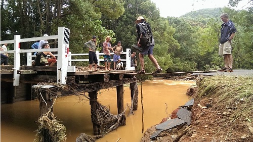
The Tweed Coast has a number of creeks and tributaries which are known as the Tweed Coastal Creeks. These creeks have a long history of flooding, with the last major flood event occurring in March 2017.
The creeks outlined below are subject to localised flash flooding.
The Tweed Coastal Creeks in the upper catchments are steep in topography causing floods to rise and fall quickly. The creeks then lead to a broad coastal floodplain extending between Kingscliff and Billinudgel.
Anecdotal intelligence suggests that there is very little chance of riverine flooding of these creeks, except in a Major or a Probable Maximum Flood (PMF) flood event.
Tweed Coast Towns/Villages affected by Flooding
The townships of Bogangar/Cabarita Beach, Hastings Point, Pottsville, Burringbar, Mooball, Wooyung and Crabbes Creek all have frequently experienced inundation from floodwaters, caused by two factors: heavy rainfall over the creek catchments and/or high tailwater levels in the ocean due to storm surge or exceptional tidal conditions.
History of flooding in the Coastal Creeks area
The February 1954 flood, the largest flood on record, caused major inundation in all flood prone regions. Severe flooding was experienced in the areas downstream of Chinderah due to a combination of the ocean storm tide, a congested river entrance, and flooding from catchment runoff.
The most recent major flood event occurred in March 2017 (Ex-TC Debbie) which peaked at 2.25m on the Chinderah Gauge on 31 March 2017, and caused significant inundation of low lying areas of the lower Tweed and Tweed Coastal Creek catchments. This severe weather event resulted in above floor inundation flooding, mass isolation of residential and rural communities, and major and widespread road network disruption and the inundation of the M1 Pacific Highway near Chinderah.
The Tweed Coast will flood again. That's a fact!
Yes you are!
Many areas of Burringbar and Crabbes Creek catchments are known to flood. Key areas of concern include:
In these areas, floods can occur within a few hours of heavy rainfall. This doesn't leave much time for resident to prepare and/or evacuate.
The small Burringbar Creek and Crabbes Creek catchments are not covered by Bureau of Meteorology flood warnings as the time between rainfall and flooding is too short. Therefore, Tweed Council plans to develop an automated flash flood warning system to provide advanced notice of approaching floods to local residents.
Yes you are!
Yes you are!
Yes you are!
Yes you are!
Yes you are!