Developing coastal trough with increasing rain, wind and seas in Northern NSW
12/12/2020 03:21 PM
Weather situation
Forecasters are closely monitoring a coastal trough which is expected to bring periods of widespread prolonged rainfall and thunderstorm activity, along with increased wind and seas, to northern coastal districts of NSW over the coming days.
Today there is expected to be temporary reprieve in the rain over northern NSW as the system (and its rain) intensifies and shifts north of our border. This system is expected to shift back over NSW again from Monday.
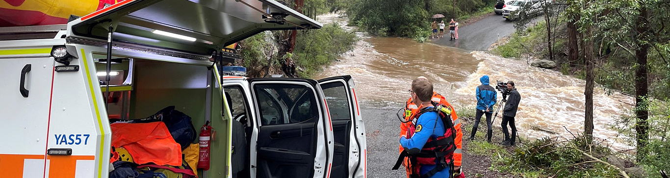
Intense rainfall rates are forecast, with the potential for localised flash flooding today over the Mid North Coast and the Northern Rivers district during Monday.
Current conditions
A Severe Weather Warning for heavy rainfall, damaging winds, abnormally high tides and damaging surf is current for people in Northern Rivers and parts of Mid North Coast. Heavy rain redeveloping along northern parts of coast late Sunday or early Monday.
Also a Moderate to Major Flood Warning for the Bellinger River - River levels at Thora and Bellingen are expected to remain below minor levels today.
Marine Wind Warning and Hazardous Surf Warning have been issued.
People are encouraged to visit the Bureau of Meteorology’s website for more information about the weather and keep note of any potential severe weather warnings in place.
NSW SES would like to remind communities in northeast NSW to stay vigilant over the next few days as more heavy rain is on its way.
Flash floods are dangerous and can happen anywhere there is localised heavy rainfall. If you come across a flooded road, simply stop and turn back.
Never drive, ride or walk through floodwater. Learn more about the dangers of flash flooding https://bit.ly/2HW1fjT
How can you prepare?
To prepare for storms and potential floods, NSW SES is asking people to:
- Never, drive, ride or walk through floodwater – floodwaters are deceptive and dangerous.
- Keep clear of creeks and storm drains.
- Monitor the weather situation closely by keeping an eye on the Bureau of Meteorology and our website and social media channels.
- Keep your car clear of trees and powerlines and keep it undercover where possible.
- Tie-down any larger objects, such as trampolines, that are likely to fly away in strong winds.
- Limit any unnecessary travel. If you must travel, avoid low-lying flash flood hotspots.

For emergency help in flood and storms, call NSW SES on 132 500, if the situation is life-threatening call Triple Zero (000) immediately.