The Winter Weather is here, just in time for the Weekend
12/07/2019 12:47 PM
Cold and blustery winter weather in New South Wales, particularly southern and centrals parts of NSW have been welcomed by strong westerly winds which are forecast as a cold front moves through the state later today and during Saturday morning. Another front is expected on Sunday too.
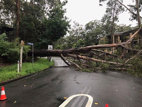
This cold front is bringing damaging winds in the Alpine region will continue. Strong winds away from the alpine peaks are expected through the weekend. Districts that may be impacted include Snowy Mountains, ACT (including Canberra), South Coast, Illawarra, Southern Tablelands, Central Tablelands (including the Blue Mountains) and South West Slopes. Damaging winds may impact Sydney on Saturday morning.
Snow is expected to fall to around 1100m around the Alpine peaks tonight with the ski resorts expected to see a further 25 to 50 cm of snow today. This is on the back of about 20 – 30 cm of snow yesterday. During Saturday morning, snow is forecast for in the south (such as Tumburumba) above 600m, extending to above 900 metres over the Central Tablelands and the Oberon Plateau, possibly affecting places like Orange and even potentially extending as far north as the Barrington Tops. Precipitation totals outside the Alpine Region are not expected to be high (only a few cm of snow).
The combination of snow and strong winds will mean blizzard conditions and low visibility for the alpine peaks and ski resorts. This will also impact driving conditions around the Snowy Mountains. As there is the chance of snow down to Jindabyne, access roads to the ski fields will be dangerous.
During the day temperatures are likely to be 3-5 degrees cooler than average across most of the state during the weekend, though the wind chill factor from these strong winds will make temperatures feel even colder. For Sydney, daytime temperatures over the weekend are likely to be in the mid-teens. Wind chill from strong and gusty winds will mean the temperature will feel significantly cooler, by up to 10 degrees!
For more information regarding the weather and warnings, visit the Bureau of Meteorology
What you can do to prepare:
- Move your car undercover and away from trees.
- Secure or put away loose items around your house, yard and balcony.
- Keep at least 8 metres away from fallen powerlines or objects that may be energised, such as fences.
- Stay indoors away from windows, and keep children and pets indoors as well.
- Prepare your home
Pets are important:
- Consider pet safety during storms
- What you will do with pets if you are required to evacuate or leave your property including moving pets safely
- Here are some tips for looking after your pets before a storm
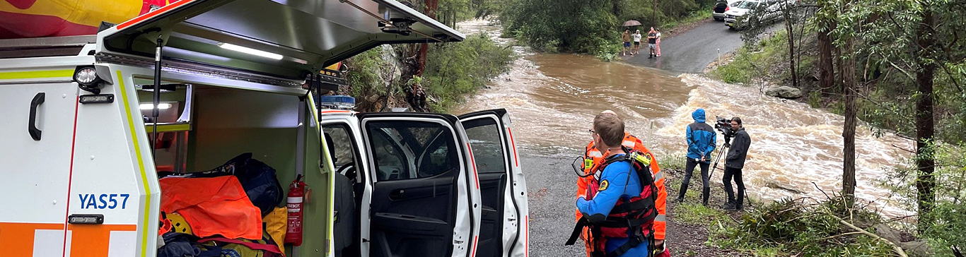
For emergency help in flood and storm emergencies, please phone NSW SES on 132 500.
Learn more about When To Call NSW SES.
For up to date information follow us on Facebook and Twitter