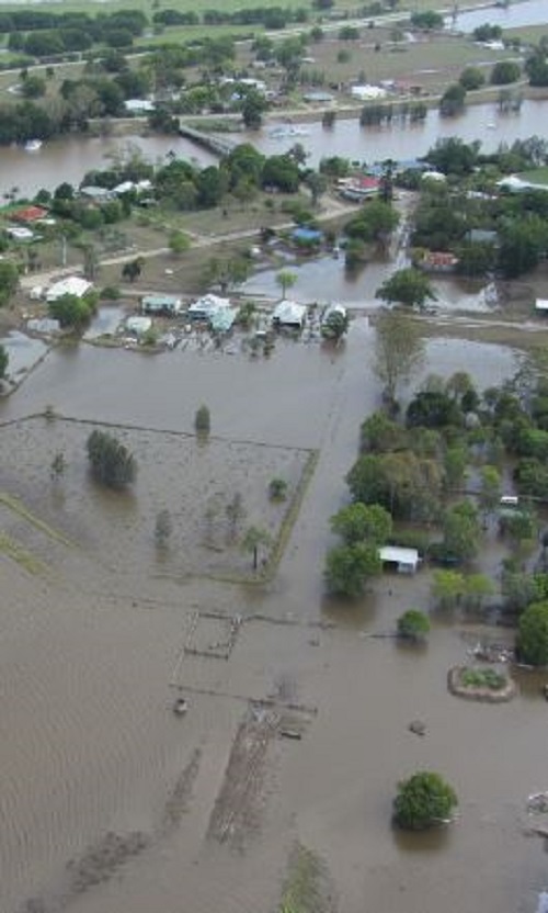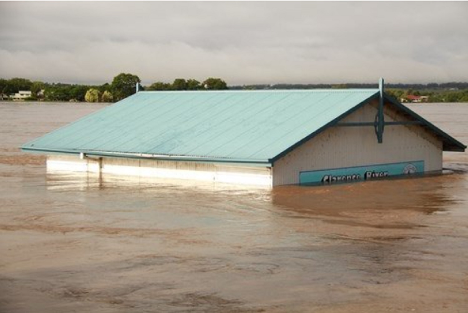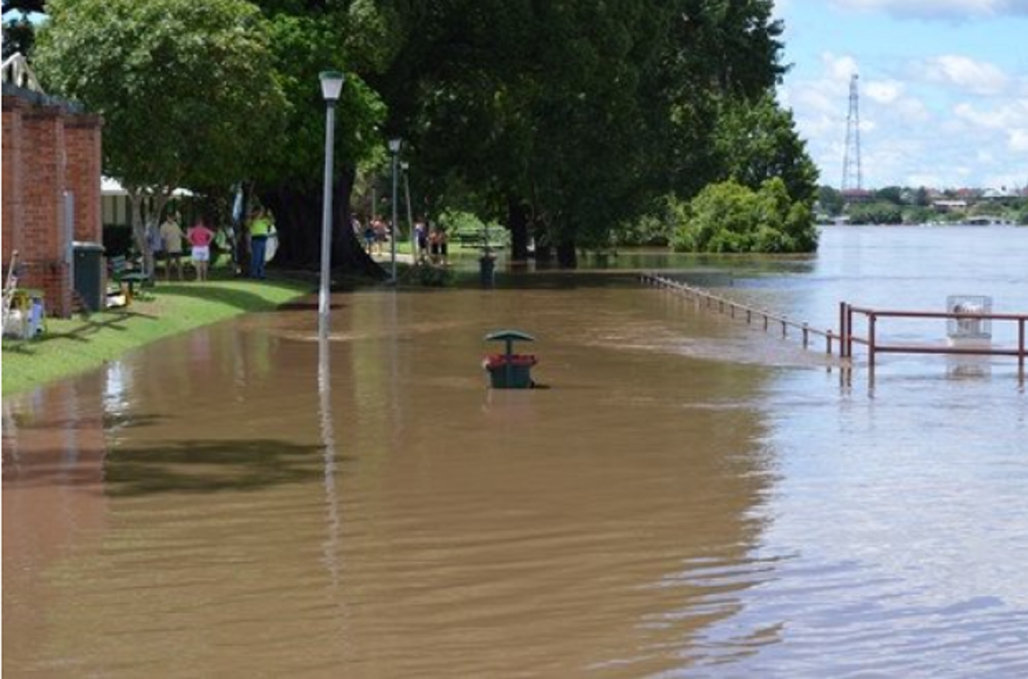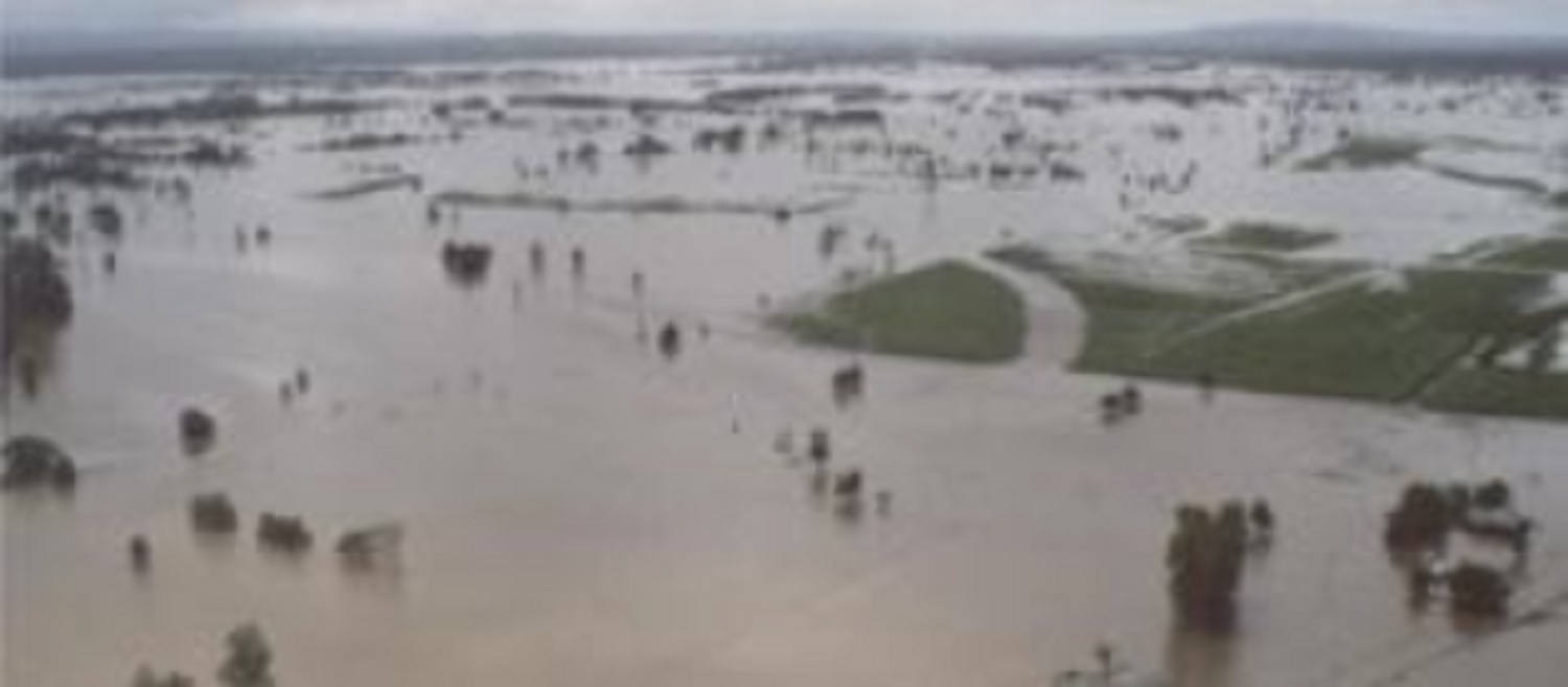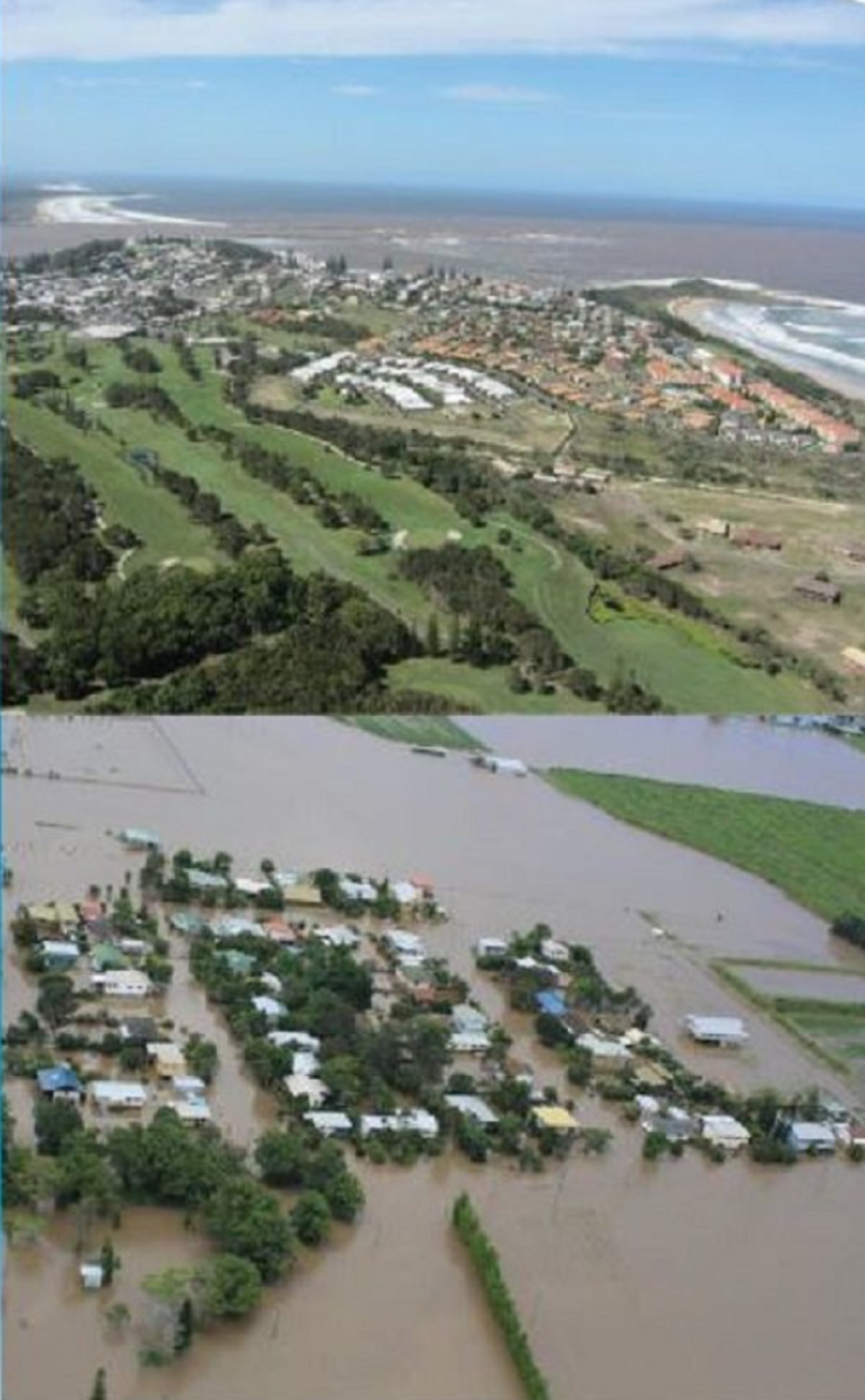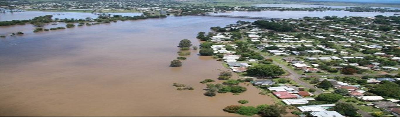
The Clarence River is one of the largest coastal rivers in NSW and has a long history of regular flooding. In January 2013 the Clarence Valley experienced extensive flooding. This was a flood of record at numerous locations.
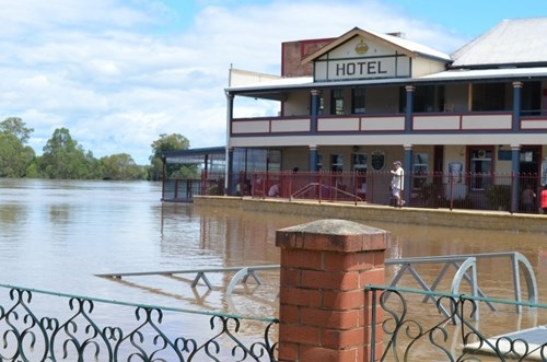
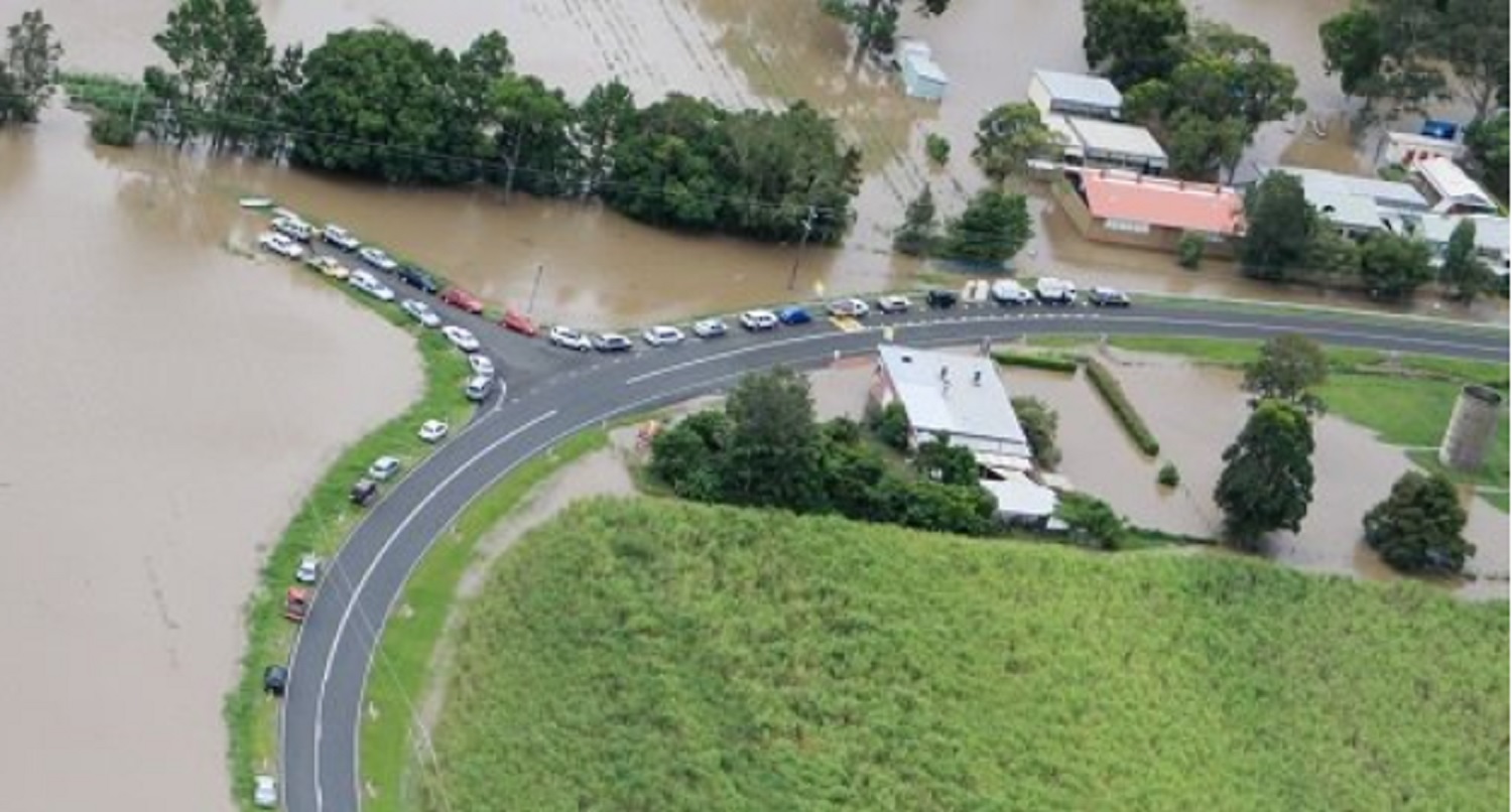
Grafton and Maclean are two of the larger townships on the Clarence River and both have levee systems built to protect them from major flooding. In 2013 the flood reached 8.08m at the Grafton gauge and spilled over sections of the Grafton levee. If this levee was to overtop, the consequences for those inside the levee could be disastrous.
Due to the size of the Clarence Valley, the information has been broken into three sections:
Knowing the flood potential of where you live, work and visit in the Clarence Valley LGA is important to keeping yourself, your family and others safe during floods.
See below to find out more about floods in your area, and steps you can take before, during and after flooding.
Yes you are!
The Clarence River is the largest coastal river in New South Wales in terms of both catchment area and discharge. It has a long history of regular flooding.
In January 2013 the Clarence Valley experienced extensive flooding. This was a flood of record at numerous locations including Grafton. Significant flooding has also occurred in 1890, 1950, 1954, 1963, 1967, 2001 and more recently 2009 and 2011.
Grafton and South Grafton have a series of levees built over the past four decades. In most years, flooding will occur outside this levee system affecting farm properties, some homes and businesses. The current levee system is designed to protect Grafton and South Grafton properties for a flood similar to that experienced in January 2013. This flood resulted in minor overtopping of low points on the levee.
Floods in excess of the levels reached in 2013 are possible and have the potential to cause major impacts on the community including large-scale evacuations. Localised heavy rainfall may cause stormwater ponding in low-lying areas within the current levee system. This is not associated with riverine flooding and is not dependent on the Clarence River being in flood.
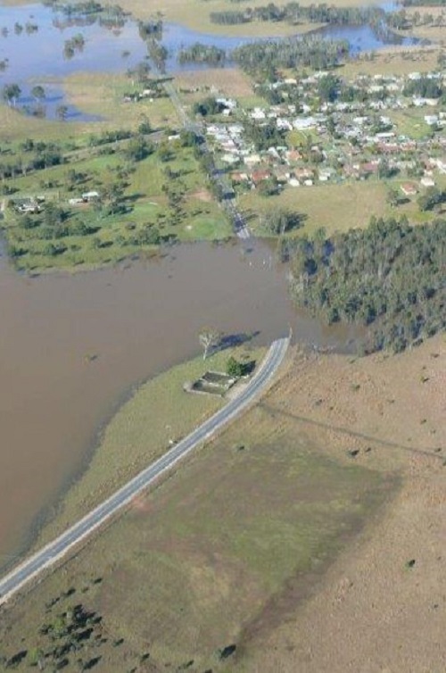
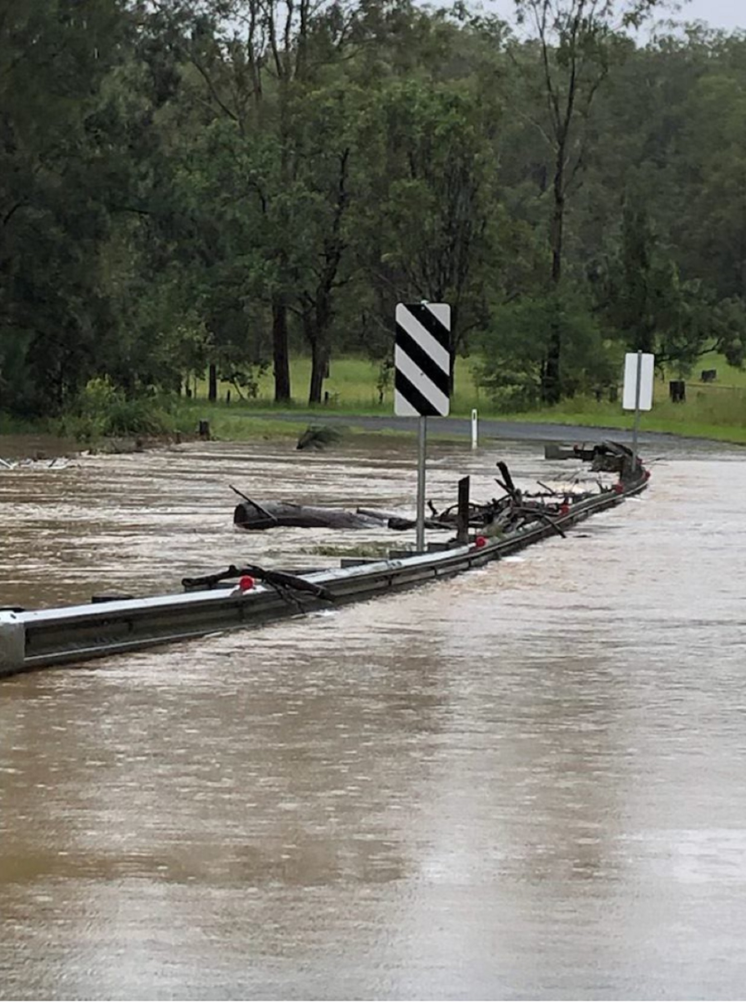
During times of flood the local road network may experience disruption and access routes may be closed. These closures can include the Big River Way, Gwydir Highway, Orara Way, Summerland Way and other local roads.
To understand what happens in a Grafton and South Grafton flood, it is important that all residents and businesses know:
The Grafton Prince Street Gauge, is the guide for riverine flood levels that impact the Grafton and South Grafton area.
Please click on the Grafton and South Grafton FloodSafe Guide for information about the Prince Street Gauge and what consequences occur at different flood heights.
Yes you are, but mainly due to isolation.
Cangai, Baryulgil, Jackadgery, Coombadjha and Carnham are villages located near the Gibraltar Ranges west of Grafton. This area is where upper catchment tributaries including the Mann River and the Nymboida River flow into the Clarence River.
Properties and villages may become isolated due to road closures following heavy rainfall or land slips. Key roads may include Gwydir Highway, Clarence Way, Baryulgil Road, Cangai Road Bridge, Carnham Road and Dandahra Road.
Please click on the Cangai and Surrounding Villages FloodSafe Guide for further information.
Yes you are!
The Clarence River is the largest coastal river in NSW in terms of both catchment area and discharge. It has a long history of regular flooding.
In January 2013 the Clarence Valley experienced extensive flooding. This was a flood of record at numerous locations. Significant flooding also occurred around Copmanhurst and Junction Hill in 1890, 1950, 1954, 1963, 1967. 1976. 2001, 2009 and more recently 2011.
The village of Copmanhurst marks the upper limit of tidal influence and of extensive floodplain development. Below the village, the valet gradually broadens into a wide, swampy plain. Many impacts in and around Copmanhurst are due to local flooding of inflowing streams and backup flooding rather than directly from the Clarence River.
Villages and rural properties near Baryulgil, Malabugilmah, Fine Flower, Coaldale, Eatonsville, Gordonbrook, Koolkhan, Moleville Creek, Upper Copmanhurst and Copmanhurst are prone to isolation, usually early in a flood on the Clarence River. In a major flood some properties may experience over-floor level flooding and some residents may need to evacuate.
The rugged country in the western part of the Clarence Valley contains several camping areas in which people can be stranded during floods for several days.
During times of flood the local road network may experience disruption and access routes may be closed. These closures may include the old Pacific Highway, Gwydir Highway, Orara Way, Summerland way and other local roads. Access between Grafton and Copmanhurst will close at varying heights and locations during a flood.
To understand what happens in a Copmanhurst flood, it is important that all residents and businesses know:
The Copmanhurst Gauge, is the guide for riverine flood levels that impact the Copmanhurst area. This gauge is not used for flood predictions by the Bureau of Meteorology, but is manually read by NSW SES members when conditions allow.
Please click on the Copmanhurst FloodSafe Guide for information about the Copmanhurst Gauge and what consequences occur at different flood heights.
Yes you are!
Ulmarra is located on the eastern side of the Clarence River down stream from Grafton. Ulmarra has a levee facing the Clarence River, but the eastern and southern portions of the town are not protected from smaller tributaries and localized flooding. Inundation from Swan Creek may occur in major floods and some residents may need to evacuate.
Properties in rural areas between Ulmarra and Tucabia may become isolated during minor floods so it is important that residents plan ahead. During major floods, most local roads may close. Affected residents need to evacuate well before a major flood level is reached.
To understand what happens in an Ulmarra flood, it is important that all residents and businesses know:
The Ulmarra Gauge, is the guide for riverine flood levels that impact the Ulmarra area.
Please click on the Ulmarra and Tucabia FloodSafe Guide for information about the Ulmarra Gauge and what consequences occur at different flood heights.
Yes you are!
Tucabia is located on the east bank of Coldstream River. During major floods low-lying areas may become inundated and local road closures may cause some properties to be isolated.
Properties in rural areas between Ulmarra and Tucabia may become isolated during minor floods so it is important that residents plan ahead. During major floods, most local roads may close. Affected residents need to evacuate well before a major flood level is reached.
To understand what happens in a Tucabia flood, it is important that all residents and businesses know:
The Tucabia Gauge, is the guide for riverine flood levels that impact the Tucabia area. This gauge is not used for flood predictions by the Bureau of Meteorology.
Please click on the Ulmarra and Tucabia FloodSafe Guide for information about the Tucabia Gauge and what consequences occur at different flood heights.
Yes, some areas are at risk!
Lawrence is located on the north bank of the Clarence Valley at the junction with Sportmans Creek, approximately half way between Brushgrove and Maclean. The majority of the town does not flood, however there are residential and non-residential properties that may experience over-floor flooding and some residents may need to evacuate.
The periods of isolation for these areas can vary depending on the size and duration of the flood. Any residents wanting to leave the area would need to do so before the onset of flooding causes local road closures.
To understand what happens in a Lawrence and Southgate flood, it is important that all residents and businesses know:
The Lawrence Gauge, is the guide for riverine flood levels that impact the Lawrence and Southgate area. This gauge is not used for flood predictions by the BOM, but is read by local SES members when condition allow and broadcast through local media
Please click on the Lawrence and Southgate FloodSafe Guide for information about the Lawrence Gauge and what consequences occur at different flood heights.
Yes you are!
The village of Southgate is located opposite Ulmarra on the northern floodplain of the Clarence river. Southgate may become isolated during major floods when Lawrence Road cuts off the village to the east and west. The majority of the area would become inundated in major floods and some residents may need to evacuate.
The periods of isolation for these areas can vary depending on the size and duration of the flood. Any residents wanting to leave the area would need to do so before the onset of flooding causes local road closures.
To understand what happens in a Southgate flood, it is important that all residents and businesses know:
The Grafton Prince Street Gauge, is the guide for riverine flood levels that impact the Southgate area.
Please click on the Lawrence and Southgate FloodSafe Guide for information about the Prince Street Gauge and what consequences occur at different flood heights.
Yes you are!
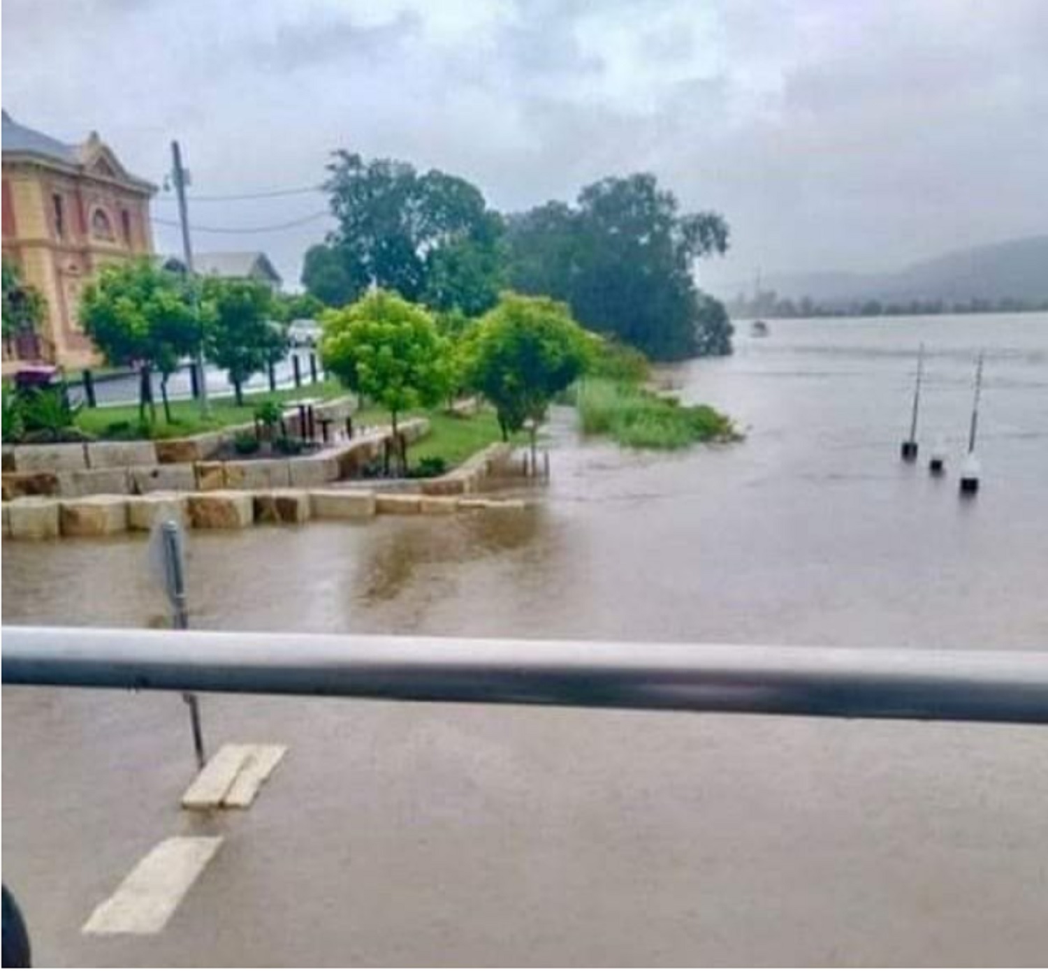
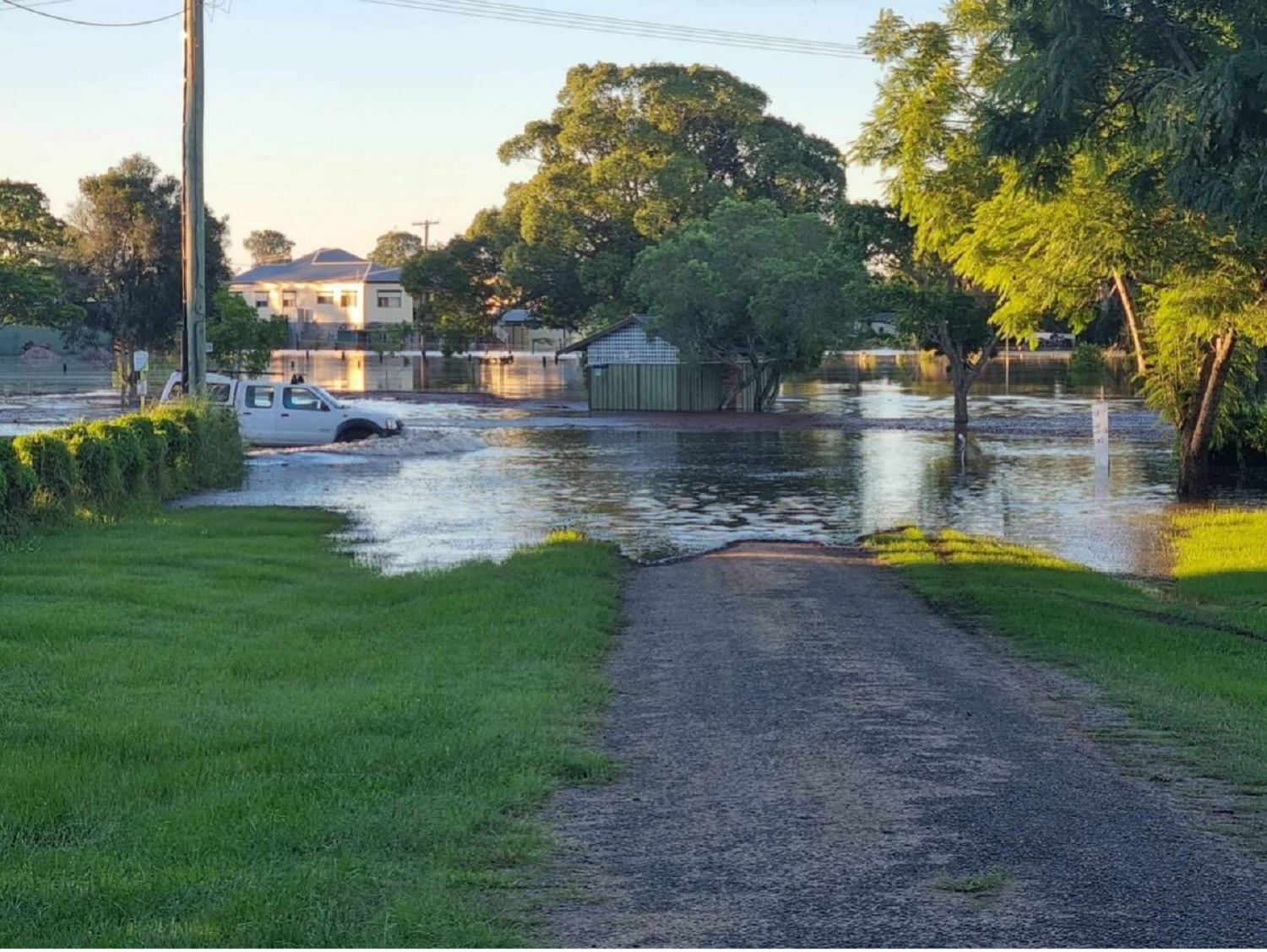
Maclean is located downstream of Grafton and is the main centre for residents of Woodford, Harwood, Chatsworth and Warregah Islands. All these are extremely flood prone and strongly affected by tides and oceanic conditions.
Maclean has a levee which protects the CBD and residential areas along the Clarence River to a flood height of 3.30m. An overtopping or failure of the levee would cause these areas to be inundated. The town may become isolated during minor floods due to local road closures.
Surrounding Villages
Ilarwill is located on Woodford Island upstream from Maclean on the south bank of the Clarence River. The majority of Ilarwill is located above major flood level but becomes isolated when Lawrence Road and MacFarlanes Bridge are closed.
Townsend is located south east of Maclean on the South Arm of the Clarence River. A small number of homes and businesses may be surrounded by water in a major flood and the village may become isolated. The main access road to Maclean from Townsend is Brooms Head Road, which can close during major floods.
Harwood Island is located north of Maclean in the north bank of the Clarence River. Access to the island can be cut in a minor flood when the village is isolated. Much of the land on Harwood Island would be inundated in a minor flood and most houses would be surrounded by floodwater in a moderate flood. A major flood causes some homes and businesses to become inundated and require evacuation.
To understand what happens in a flood in the Maclean and surrounding villages, it is important that all residents and businesses know:
The Maclean Gauge, is the guide for riverine flood levels that impact the Maclean, Harwood, Goodwood Island, Chatsworth Island area.
Please click on the Maclean and Harwood FloodSafe Guide for information about the Maclean Gauge and what consequences occur at different flood heights.
Yes you are!
The Clarence River is the largest coastal river in New South Wales in terms of both catchment area and discharge. It has a long history of regular flooding.
In January 2013 the Clarence Valley experienced extensive flooding. This was a flood of record at numerous locations. Significant flooding in Brushgrove and Cowper has also occurred in 1950, 1963, 1967, 1974, 1976, 1996, 2001, 2009 and 2011.
Brushgrove is a rural village on the southern tip of Woodford Island in the Clarence River floodplain. Brushgrove may become isolated by floods from 3.90m. Higher floods may cause backwater flooding and inundation of Brushgrove, therefore residents need to evacuate before flooding occurs. The embankment facing the Clarence River may also overtop. In a larger flood there would likely be in excess of 2m of water under some properties, most of the roads would be under water and septic systems may become unserviceable.
Cowper is located to the south of Brushgrove on the South Arm of the Clarence River. Floods predicted to be higher than 4.0m may cause the majority of dwellings in Cowper to be isolated and some to become inundated. Larger floods may inundate the entire community, so affected residents need to evacuate before flooding occurs.
Tyndale is located on the Pacific Highway halfway between Cowper and Maclean. The majority of land at Tyndale is flood free, but the area can become isolated if the Pacific Highway is closed.
To understand what happens in a Brushgrove and Cowper flood, it is important that all residents and businesses know:
The Brushgrove Gauge, is the guide for riverine flood levels that impact the Brushgrove and Cowper area. This gauge is not used for flood predictions by the BOM. It is read by local SES members and the readings are broadcast through local media.
Please click on the Brushgrove and Cowper FloodSafe Guide for information about the Brushgrove Gauge and what consequences occur at different flood heights.
Yes you are!
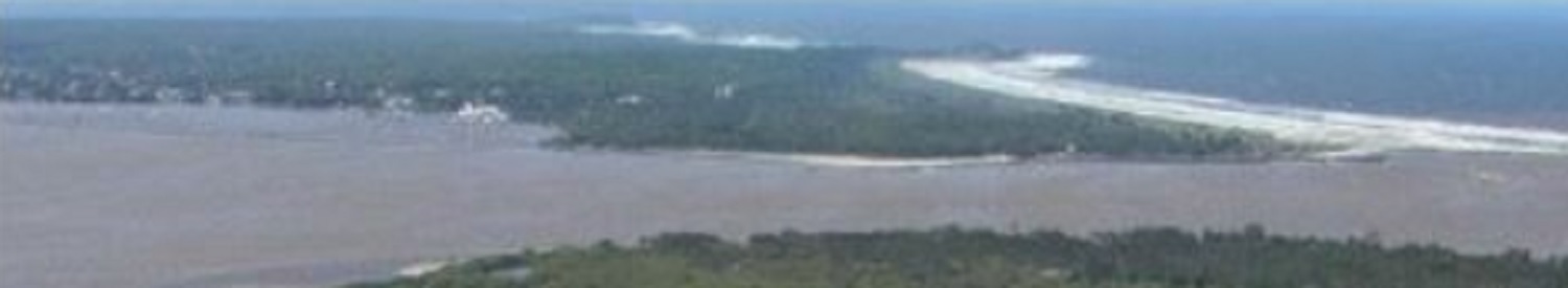
Iluka is located on the northern bank of the mouth of the Clarence River, opposite Yamba. During minor floods, this area is protected by a low levee. Most of Iluka is not affected during major floods, however a number of low-lying properties including the caravan park may become flooded either from elevated ocean levels or from the river. The effects of floods in the area are dependent on tides and oceanic conditions.
Low lying roads including the Iluka Road may become closed during minor floods, causing the area to become isolated.
Woombah is located several kilometers upstream of Iluka. The eastern end of the village may become inundated during major floods and some residents may need to evacuate.
All residents and businesses on Goodwood Island, may become inundated during floods and may need to evacuate.
The period of isolation for these areas can vary depending on the size and duration of the flood, as well as high tides preventing drainage to the sea. Any residents wanting to leave the area would need to do so before the onset of flooding causes the Iluka Road to close.
To understand what happens in an Iluka flood, it is important that all residents and businesses know:
The Maclean Gauge, is the guide for riverine flood levels that impact the Iluka area.
Please click on the Iluka FloodSafe Guide for information about the Maclean Gauge and what consequences occur at different flood heights.
Yes you are!
Yamba is located on the southern bank of the mouth of the Clarence River. The main impact of floods in the area is isolation, however several residents and commercial properties can be inundated in severe floods. Even in minor floods, Yamba may become isolated when Yamba Road closes. Another consideration during local floods is the influx of tourists during holidays and summer season, who may be unaware of the local effects of flooding.
Palmers Islands is located directly west of Yamba on the southern bank of the Clarence River. Most of the land on the island is prone to flooding. In a minor flood, Palmers Island becomes isolated and surrounded by flood water. In a major flood some properties may experience over-floor flooding and some residents may need to evacuate.
Rural land along the Clarence River around Wooloweyah Lagoon can also be inundated and substantial numbers of rural properties can become isolated.
The period of isolation for these areas can vary depending on the size and duration of the flood, as well as high tides preventing drainage to the sea. Any residents wanting to leave the area would need to do so before flooding causes Yamba Road to close.
To understand what happens in a Palmers Island and Yamba flood, it is important that all residents and businesses know:
The Maclean Gauge, is the guide for riverine flood levels that impact the Yamba and Palmers Island area.
Please click on the Yamba and Palmers Island FloodSafe Guide for information about the Maclean Gauge and what consequences occur at different flood heights.
Yes you are!
The Orara River flows northward through a long, narrow valley and drains parts of the Dorrigo Plateau and the Coastal Range to join with the Clarence River. It has a long history of regular flooding.
Coutts Crossing is located south of Grafton on the southern bank of the Orara River. The town is above major flood level, but surrounding areas may become isolated when local roads are progressively closed due to floodwater. These areas include Middle Creek, Lower Kangaroo Creek, Kangaroo Creek, Shannondale, Levenstrath and Braunstone.
The Nymboida River drains the New England Tablelands and the Dorrigo Plateau, flowing north to join with the Mann River and Jackadgery Creek, which then flow into the Clarence River.
Nymboida is located south of Grafton on the eastern bank of the Nymboida River. This town is also above major flood level, but surrounding areas including Buccarumbi, Billy's Creek, and large areas of state forest may become isolated when local roads are closed due to floodwater.
The period of isolation for these areas can vary depending on the size and duration of the flood. Any residents wanting to leave the area would need to do so before the onset of flooding causes local roads to close.
In January 2013 the Orara and Nymboida Rivers experienced major flooding. Significant flooding has also occurred in 1950, 1955, 1959, 1962, 1963, 1967, 1974, 1980, 1996, 2001 and more recently in 2009.
To understand what happens in a flood affecting the Coutts Crossing and Nymboida area, it is important that all residents and businesses know:
The Coutts Crossing Gauge is the guide for flood levels in the Coutts Crossing area. The Nymboida Gauge is the guide for flood levels in the Nymboida Gauge.
Please click on the Coutts Crossing and Nymboida FloodSafe Guide for information about the gauge and what consequences occur at different flood heights.
Yes you are!
Between Grafton and the coastal township of Wooli is a series of rivers and swamp areas influenced by the Coldstream River, Bookram Creek, Minnie Water and Lake Hiawatha, Barcoongere River and Wooli Wooli River.
Wooli is located at the mouth of the Wooli Wooli River, which is a tidal river prone to flooding during heavy rain. This results in low-lying areas of the township becoming inundated. Since a major flood in 1974 there have been minor floods in 2001 and below minor floods in 2008, 2010, 2011 and 2013.
Wooli is also affected by coastal erosion when there is a combination of severe weather events such as large waves, storm surge, spring tides and gale force winds.
Minnie Waters village and Diggers Camp are located north of Wooli. These are not flood prone areas but may become isolated when local roads close.
Pillar Valley is a low-lying area between Wooli and Ulmarra and may become isolated when local roads close due to heavy rain.
During periods of prolonged rainfall, low level crossings may close causing isolation of townships and villages. These crossings include Firthheinz Road at the junction of Wooli Road, Sandy Crossing on Eight Mile Lane and White Bridge on the Wooli-Tucabia Road.
To understand what happens in a flood affecting the Wooli area, it is important that all residents and businesses know:
The Wooli Solitary Island Marine Park Resort Gauge, is the guide for riverine flood levels that impact the Lawrence and Southgate area. This gauge is not used for flood predictions by the BOM, but is read by local SES members when condition allow and broadcast through local media
Please click on the Wooli and Pillar Valley FloodSafe Guide for information about the gauge and what consequences occur at different flood heights.
Yes you are!
Sandon is a small community on the east coast with mainly holiday houses and a caravan park. Rather than being affected by riverine flooding, Sandon is affected by storm surge flooding or large tidal events. Under these conditions, parts of the caravan park may become flooded and Sandon River Road may close, isolating the area.
Brooms Head is also on the coast and affected by storm surge flooding in large tidal events. Under these conditions, parts of the caravan park can become flooded, coastal erosion may occur and Brooms Head Road to Maclean may close and isolate the area.