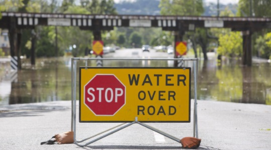
The Byron Shire Local Government Area (LGA) is located in the Northern Rivers area of New South Wales. The area is affected by both riverine and flash flooding which can cause devastating over floor flooding in some locations and road closures due to flash flooding across low lying roads and crossings.
The Brunswick River is the main river system in the Byron LGA with a number of smaller tributaries such as Lacks Creek and Marshalls Creek feeding into it which can contribute to significant flooding in certain areas. Flooding in the Brunswick River and its tributaries are a part of the natural cycle of the river system. People who live, work and visit the Byron Shire need to be aware of their flood risk and take steps to prepare.
Knowing the flood potential of where you live, work and visit in the Byron Shire is important to keeping yourself, your family and others safe during floods.
See below to find out more about floods in your area, and steps you can take before, during and after flooding.
Yes you are!
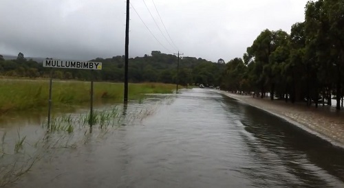
Mullumbimby, with a population of approximately 4000 people, is located in the Brunswick Valley in the Northern Rivers of NSW at the meeting of the Brunswick River and Mullumbimby Creek.
The Brunswick Valley is a flash flood catchment. Flash flooding can cause loss of life from high velocity floodwater and overland flows cause isolation, inundations and road closures.
Upstream of Mullumbimby the streams are largely confined to their main channels, but at Mullumbimby and downstream there are extensive floodplains.
Flood heights in Mullumbimby can also be affected by tidal influence. When the tide is on the make it will hold water back with a tendency to raise the water level. As the tide starts to ebb the level usually falls very quickly.
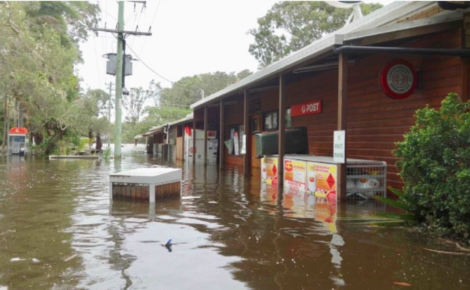
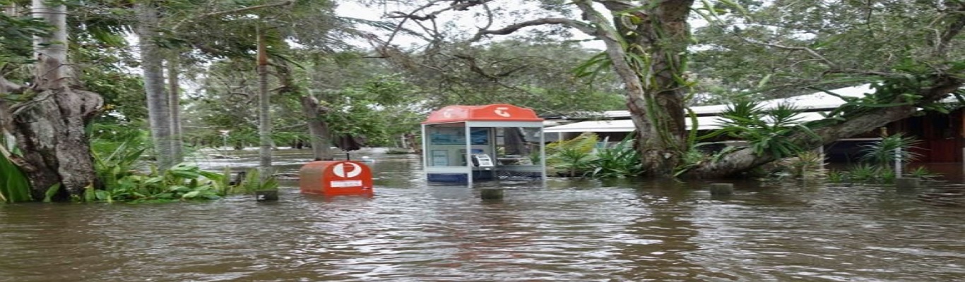
Flood height recording has occurred at Mullumbimby since 1954 and the town has experienced several major floods during its history. The last major flood occurred in May 1987. Known as the Mother’s Day Flood, it was the most severe in living memory. During a flood, there can be significant urban flooding, extensive road closures and disruption to road networks, infrastructure damage, including roads, bridges and culverts as well as power outages, sewerage system failure and water supply disruption.
It is important that residents and businesses Mullumbimby are aware of their flood risk, have a plan and know when to act.
Mullumbimby will flood again. That’s a fact!
To understand what happens in a Mullumbimby flood, it is important that all residents and businesses know:
The Federation Bridge Gauge at Mullumbimby, is the guide for riverine flood levels that impact the Mullumbimby area.
Please click on the Mullumbimby FloodSafe Guide for information about the Federation Bridge Gauge and what consequences occur at different flood heights.
Yes you are!
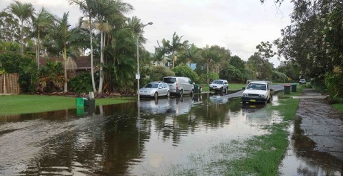
Billinudgel and Ocean Shores are located in the Brunswick Valley which is a flash flood catchment. These areas have a long history of flooding and flood water can be deep and rise and fall quickly.
Major floods have occurred in Billinudgel in 1987, 2003, 2005, 2012 and 2017. Floods higher than in these years are possible!
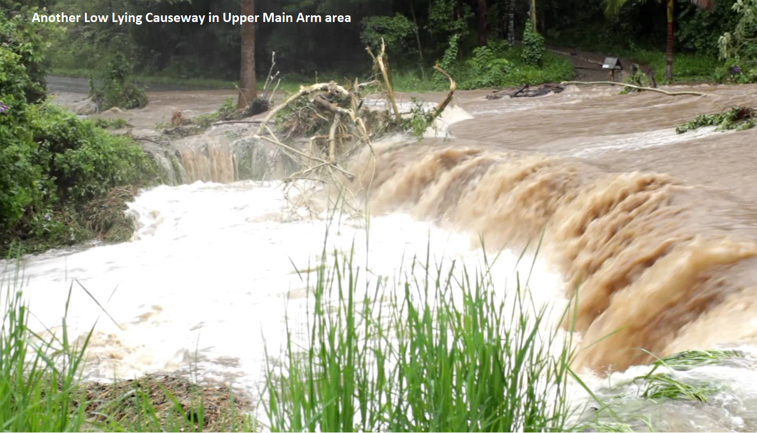
Flood behaviour in this area is complex due to the number of creeks and waterways between major floodplains, including the Yelgun Creek catchment in Tweed Shire and the Lacks and Marshalls Creek catchments in Byron Shire.
Lacks Creek flows through Middle Pocket and joins Marshalls Creek to the west of Billinudgel. Marshalls Creek then flows through The Pocket and Billinudgel and joins the Brunswick River. Billinudgel can start to flood at the western end of Wilfred Street well below the minor flood level.
Downstream of Billinudgel and the Pacific Motorway, the floodplain spreads out through Ocean Shores. Heavy localised rainfall can also result in flash flooding and road closures.
Only a few low-lying streets in Ocean Shores are affected by flooding such as Balemo Drive, Rajah Road and the Water Lily Park area. Water also backs up around the Ocean Shores Golf Course area.
Billinudgel and Ocean Shores will flood again. That’s a fact!
To understand what happens in a Billinudgel and Ocean Shores flood, it is important that all residents and businesses know:
Please click on the Billinudgel, Ocean Shores, New Brighton and South Golden Beach FloodSafe Guide (Coming soon) for information about the local gauge and what consequences occur at different flood heights.
Yes you are!
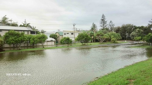
South Golden Beach and New Brighton are located in the Brunswick Valley which is a flash flood catchment. These areas have a long history of flooding and flood water can be deep and rise and fall quickly.
Flood behaviour in this area is complex due to the number of creeks and waterways between major floodplains, including the Yelgun Creek catchment in Tweed Shire and the Lacks and Marshalls Creek catchments in Byron Shire.
Lacks Creek flows through Middle Pocket and joins Marshalls Creek to the west of Billinudgel. Marshalls Creek then flows through The Pocket and Billinudgel and joins the Brunswick River.
Downstream of Billinudgel and the Pacific Motorway, the floodplain spreads out through Ocean Shores, South Golden Beach and New Brighton. Heavy localised rainfall can also result in flash flooding and road closures.
South Golden Beach is enclosed by a levee that is designed to protect it to a height of 4.2m. However, localised heavy rainfall can cause water to pond behind the levee.
The low-lying areas of New Brighton can be affected by flood water in moderate to major flood events.
South Golden Beach and New Brighton will flood again. That’s a fact!
To understand what happens in a South Golden Beach and New Brighton flood, it is important that all residents and businesses know:
Please click on the Billinudgel, Ocean Shores, New Brighton and South Golden Beach FloodSafe Guide (Coming soon) for information about the local gauge and what consequences occur at different flood heights.
When a Prepare to Evacuate - Watch and Act is issued
When a Prepare to Evacuate - Watch and Act is issued, you should prepare to evacuate. Staying inside a house, even one which you think is high enough, may be very dangerous. If you are warned to evacuate it is always safest to move to a location away from the flood affected area before floodwater arrives.
When an Evacuate Now - Emergency Warning is issued
When an Evacuate Now - Emergency Warning is issued and you leave your house:
For information on roads, contact your local council for local road closures and Live Traffic NSW for major road closures.