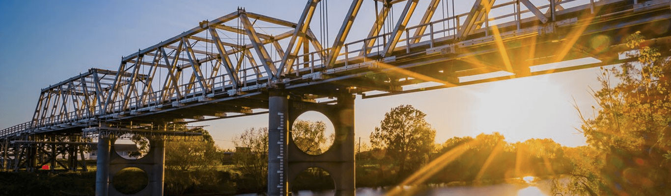
The Maitland local government area is a highly urbanised area located in the valley of the Hunter River in one of the most flood prone parts of New South Wales. The Morpeth, Duckenfield and Miller Forest area and smaller suburbs of Raworth Berry Park, Duckenfield, Brisbane Field Road, and Millers Forest mostly rural farming land.
Yes, historically flooding has been frequent and occasionally severe here, and the more serious floods have caused considerable damage. Extensive mitigation works throughout Maitland has lessened the impacts of flooding, but large parts of Maitland remain liable to flooding, particularly in the rarer, more severe events.
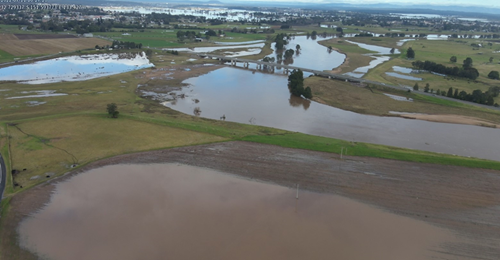
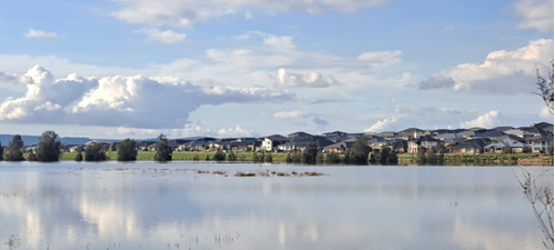
Yes, in April 2015 and July 2022, a severe weather event occurred across the Hunter Region, causing widespread flooding and storm damage for the communities of Millers Forest and Duckenfield. The intensity of rainfall and height of flood water was unprecedented, and many people were unprepared. Flooding from both the Hunter River and the Paterson River can impact the flooding in this area. The Paterson River peaked at Hinton at 5.83m (2022) and the Hunter River at Belmore Bridge peaked at 10.41m (2022) and 8.92m (2015)
To understand what happens in a Williams River flood, it is important that all residents and businesses know:
The Bureau of Meteorology (BoM) reads and refers to Belmore (Maitland) gauge (210452) McKimms Corner Gauge (561064) Morpeth gauge (561021).
|
Height (m) |
Relevance / Action |
|
12.10m |
Peak Height February 1955 |
|
11.10m |
Peak Height February 1971 |
|
10.80m |
Peak Height March 1977 |
|
10.70m |
Peak Height June 2007 |
|
10.50m |
Major Flood Level |
|
9.36m |
Peak Height March 2022 |
|
8.90m |
Moderate Flood Level & Peak Height April 2015 |
|
7.20m |
Peak height December 2021 |
|
5.90m |
Minor Flood Level |
Maitland has considerable flood mitigation works, comprising levees, floodgates, spillways, diversion banks and velocity controls. The Bolwarra floodway is part of this system it bypasses Maitland to the north and consists of the spillway, a number of control banks and the Lorn diversion bank. The Lorn diversion bank deflects floodwaters away from Lorn and diverts the main body of flow towards the lower land of Bolwarra flats.
This area Included Bolwarra, Bolwarra Heights, Largs, Pheonix Park, Brush Farm, Dunmore, Goulburn Grove, King Island, Flat Rd Area, Maitland Vale, Melville, Hillsborough and Rosebrook
Yes, floodwaters will start to seep through the rockwork of the Bolwarra spillway before floodwaters overtop the spillway. This may result in Belmore Road being inundated before the spillways overtop.
Water moving from the Bolwarra spillway through the Bolwarra- Largs can also be affected by flooding overtopping the levees from the Paterson River as it flows into Phoenix Park. Further cutting local roads and access through the area.
Yes, in April 2015 and July 2022, a severe weather event occurred across the Hunter Region, causing widespread flooding and storm damage for the communities across Maitland. Low-lying areas of Bolwarra, Largs, Dunmore, Goulburn Grove, King Island, Flat Rd Area, Maitland Vale, Melville, Hillsborough, and Rosebrook were impacted by localised flooding and the inconvenience of farm roads being closed. The Hunter River at Belmore Bridge peaked at 10.41m (2022) and 8.92m (2015) Paterson River peaked at Hinton at 5.83m (2022)
The most notable flood occurred in February 1955 which saw the Hunter River peak at 12.10m, this was prior to the Hunter Flood Mitigation Scheme being built which aims to protect and ease flooding around Maitland and surrounds. The next major flooding after the Hunter Flood Mitigation Scheme was built was February 1971 the Belmore reached 11.08m then June 2007 which saw the Belmore Bridge reach 10.70m.
To understand what happens in a riverine flood, it is important that all residents and businesses know:
The Bureau of Meteorology (BoM) reads and refers to the Belmore Bridge gauge (210458).
|
Height (m) |
Relevance / Action |
|
12.10m |
February 1955 Peak Height |
|
11.50m |
Approximate 1% AEP Event |
|
11.31m |
August 1952 Peak Height |
|
11.00m |
Floodwater likely to close Lorn Access to Bolwarra |
|
10.70m |
June 2007 Peak Height |
|
10.70m |
Bolwarra Spillway may begin to operate |
|
10.50m |
Major Flood Level |
|
8.92m |
April 2015 Peak Height |
|
8.90m |
Moderate Flood level |
|
6.80m |
Maitland Vale Rd, Rosebrook is closed |
|
6.00m |
Maitland Vale Rd, Lambs Valley is closed |
|
5.90m |
Minor Flood Level |
The Maitland and Lorn and the suburbs of South Maitland, Louth Park and Horseshoe bend, the Hunter River runs adjacent to the suburbs of Lorn and Maitland, with the Belmore Bridge connecting the two.
Yes, you are!
The Hunter River at Maitland has recorded more than 200 flood events since European settlement. After the 1955 floods the Hunter Valley Flood Mitigation Scheme is designed to lessen the effects of flooding on both rural and urban areas, reducing flood damage by modifying flood behaviour. It is a well-designed and maintained state owned engineering work, which affords significant protection from flooding to community and commercial interests. The scheme is an integrated system of levees, floodgates, and drains (assets) on the Hunter, Paterson Rivers and Wallis Creek. The scheme does not provide complete flood protection but is designed to mitigate or reduce flood. Like that of January 1955 in which 11 people lost their lives and some 2200 homes were inundated.
Yes, in April 2015 and July 2022, a severe weather event occurred across the Hunter Region, causing widespread flooding and storm damage for the communities across Maitland with localised flooding across the low-lying farmland along with the inconvenience of farm roads being closed and traffic chaos moving from Rutherford to East Maitland. The Hunter River at Belmore Bridge peaked at 10.41m (2022) and 8.92m (2015)
The most notable flood occurred in February 1955 which saw the Hunter River peak at 12.10m, this was prior to the Hunter Flood Mitigation Scheme being built which aims to protect and ease flooding around Maitland and surrounds. The next major flooding after the Hunter Flood Mitigation Scheme was built was February 1971 the Belmore reached 11.08m then June 2007 which saw the Belmore Bridge reach 10.70m.
To understand what happens in a Maitland flood, it is important that all residents and businesses know:
it is essential that all homes and businesses within these areas have an emergency plan that is designed to allow stock and belongings to be raised or relocated and to evacuate in time if required. Remaining in your home/business when it is flood affected can be dangerous. Your property may be flooded, you could become isolated (surrounded by floodwater), access to other areas might be cut and you could lose your power, water supply and other low-lying infrastructure such as sewerage.
The Bureau of Meteorology reads and refers to the Belmore Bridge gauge (210458).
|
Height (m) |
Relevance / Action |
|
12.10m |
Peak Height February 1955 |
|
11.50m |
Approximate 1% AEP Event |
|
11.31m |
Peak Height August 1952 |
|
10.70m |
Peak Height June 2007 |
|
10.50m |
Major Flood Level |
|
8.92m |
Peak Height April 2015 |
|
8.90m |
Moderate Flood level |
|
7.20m |
Peak Height December 2021 |
|
5.90m |
Minor Flood Level |
The Maitland local government area is a highly urbanised area located in the valley of the Hunter River in one of the most flood prone parts of New South Wales. The East Maitland includes the nearby suburbs of East Maitland, Rathluba, Ashtonfield, Metford, Tenambit, and the rural area of Pitnacree.
Yes, historically flooding has been frequent and occasionally severe here and the more serious floods have caused considerable damage. Extensive mitigation works throughout Maitland has lessened the impacts of flooding, but large parts of Maitland remain liable to flooding, particularly in the rarer, more severe events.
Yes, in April 2015 and July 2022, a severe weather event occurred across the Hunter Region, causing widespread flooding and storm damage for the communities in the lower parts of Melbourne Street East Maitland and South Maitland areas to be affected by rising water. Flooding from both the Hunter River and Wallis Creek can impact the flooding in this area. In July 2022 the Hunter River at Belmore Bridge peaked at 10.41m (2022) and 8.92m (2015) and Wallis Creek peaked at 7.09m (2022)
To understand what happens in a Williams River flood, it is important that all residents and businesses know:
The Maitland local government area is a highly urbanised area located in the valley of the Hunter River in one of the most flood prone parts of New South Wales. The Thornton Chisholm, and its new suburbs of Waterford, Somerset, and Sophia Waters.
Yes historically, flooding has been frequent and occasionally severe here, and the more serious floods have caused considerable damage. Extensive mitigation works throughout Maitland has lessened the impacts of flooding, but large parts of Maitland remain liable to flooding, particularly in the rarer, more severe events.
Yes, in April 2015 and July 2022, a severe weather event occurred across the Hunter Region, causing widespread flooding and storm damage for the communities in the Thornton and Chisholm. Raymond Terrace Road was cut in several place preventing traffic movement towards Maitland and Raymond Terrace for several days causing traffic chaos back through Thornton. Flooding from the Hunter River, Paterson River and Wallis Creek can impact the flooding in this area. In July 2022 the Hunter River at Belmore Bridge peaked at 10.41m (2022) and 8.92m (2015) and Wallis Creek peaked at 7.09m.
To understand what happens in a Williams River flood, it is important that all residents and businesses know: