Northern Rivers Get Ready Together
Your local SES would like to partner with you to help you to develop your own Emergency Plan so you are better prepared for the next event.
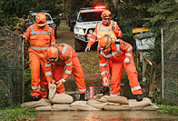
Using sandbags to protect your home
Sandbags will not stop the water completely but can reduce the amount of water entering your home. During low level flooding, sandbags placed in the right locations around your home can reduce the impact of flooding.
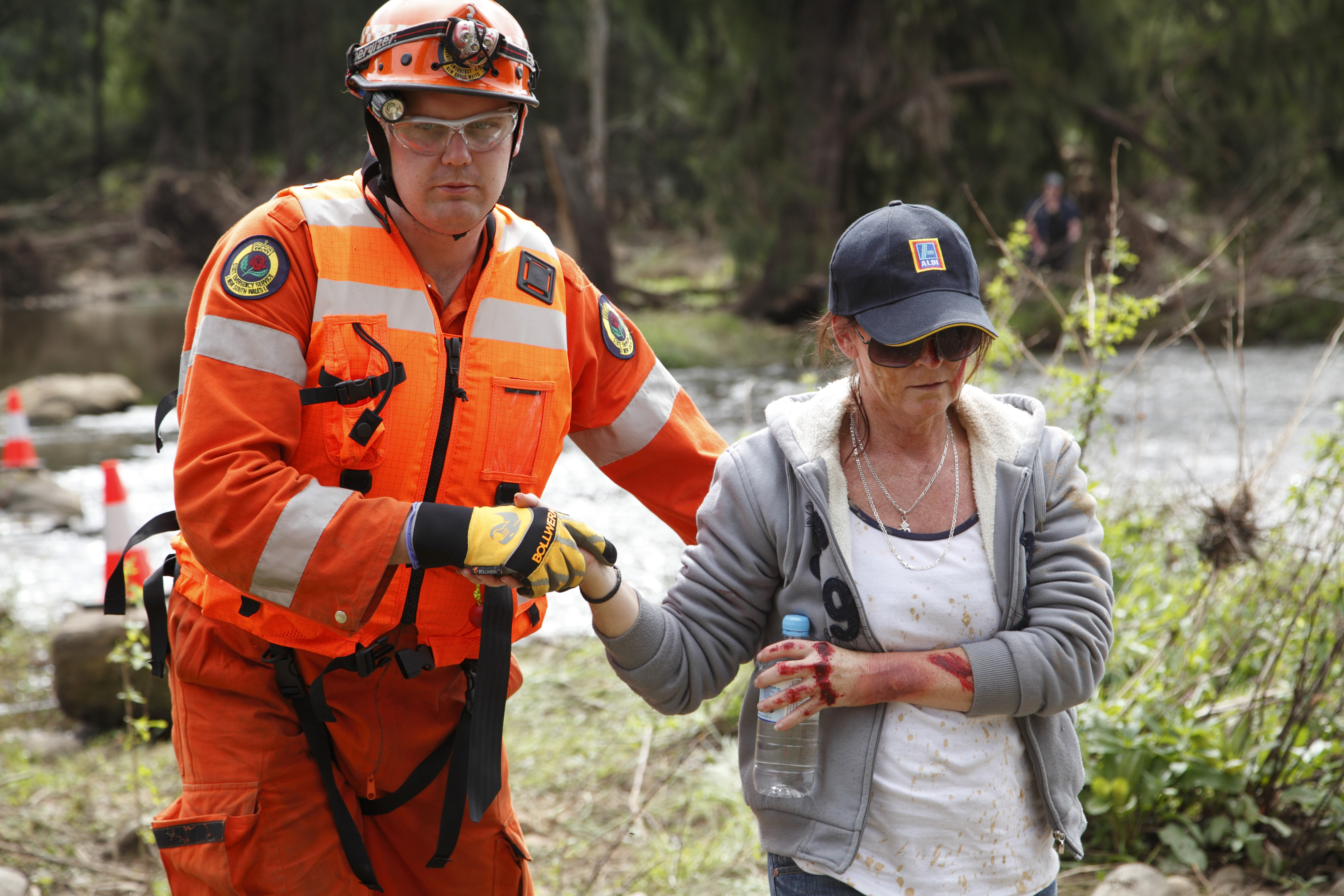
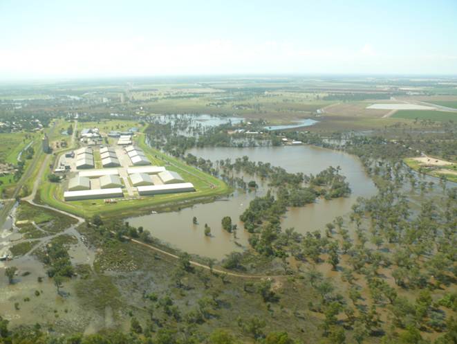
Recent Floods and Storms
You can learn a lot from the past.
Read about the significant floods and storms that have happened in your area in recent years.
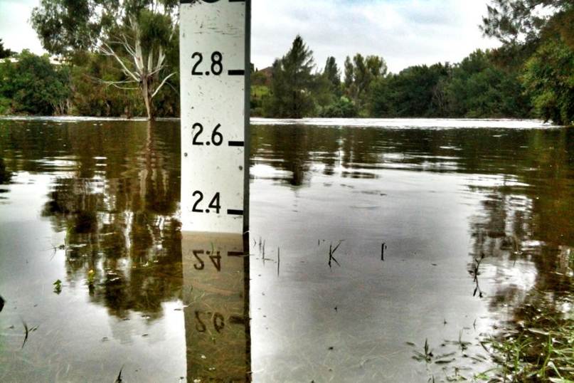
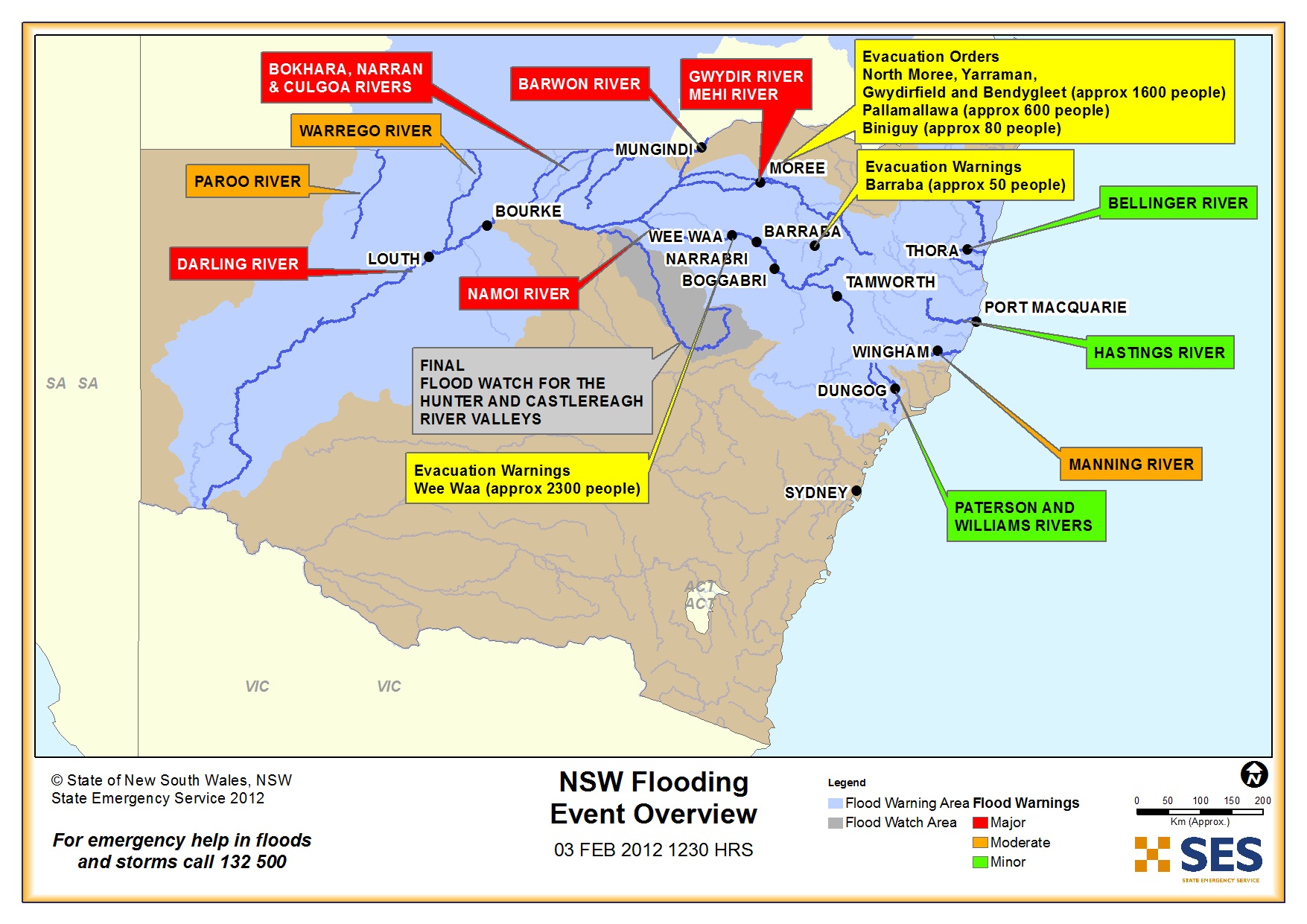
Record Floods
Here are the records of floods in your area. They may help you understand the risk in your area.
They are listed for significant river systems with key warning gauges only.
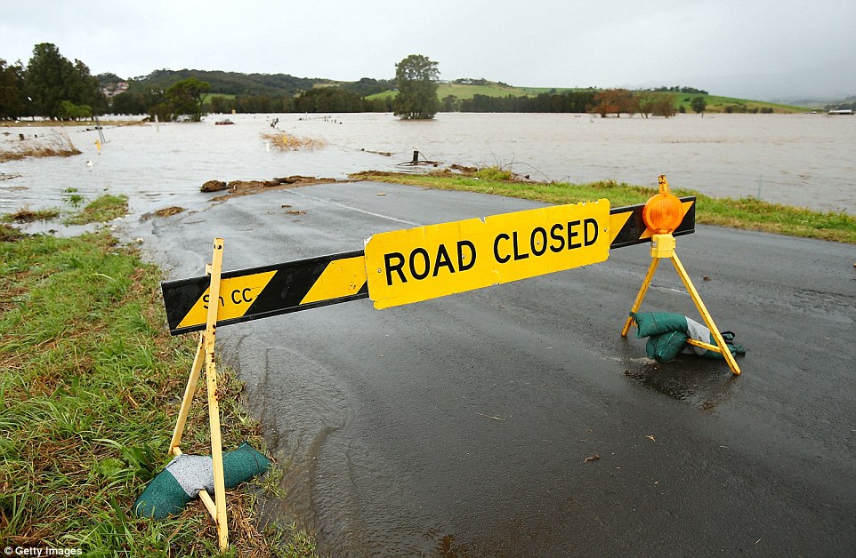
Local Road Information
Here are some handy links to Roads and Maritime Services and your local councils who manage road closures in your area.
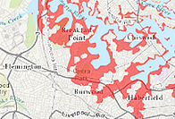
Local Rivers
A list of significant rivers in the Richmond Tweed Region of NSW and a handy link to river conditions and latest rainfall totals to help you self-assess the risk in your area.
Things to consider if you live in an urban area
Urban areas, including metropolitan, suburbs and towns, can have specific storm risks including impacts of flash flooding. It is important to remember that storm water and floodwater in urban areas can be very dangerous.

Your Local Councils
Check with your local council for information about property-specific risks, local road closures and local planning approval guidelines.
Your Local NSW SES Units
NSW is divided into 17 Regions based on major river systems. Check here to see the local Units operating in your area.
Each Region Controller is responsible for the operational control of emergency flood and storm responses, including planning, training, operational support and other functions within their area of control.

Local Radio Stations
Your local radio station can provide information and updates during emergencies that are specific to your local area

Flood Storm and Tsunami Guides
Download the FloodSafe, StormSafe and TsunamiSafe guides here to help you prepare for emergencies near you.
Flood Storm and Tsunami Plans
The NSW SES undertakes flood, storm and tsunami planning to determine how to best manage natural disasters.
Tsunami Evacuation Map
The NSW State Emergency Service (NSW SES) has released maps showing evacuation areas in the event of a land-threat tsunami.
Learn how tsunami could impact your location.
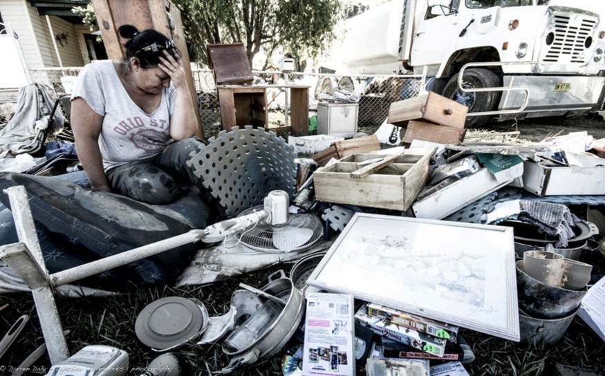
Next steps toward recovery
In NSW, recovery following a disaster is managed by a range of organisations. The NSW SES has produced a recovery guide to help you take the next steps towards recovery from floods, storms and tsunami.
News
Previous Next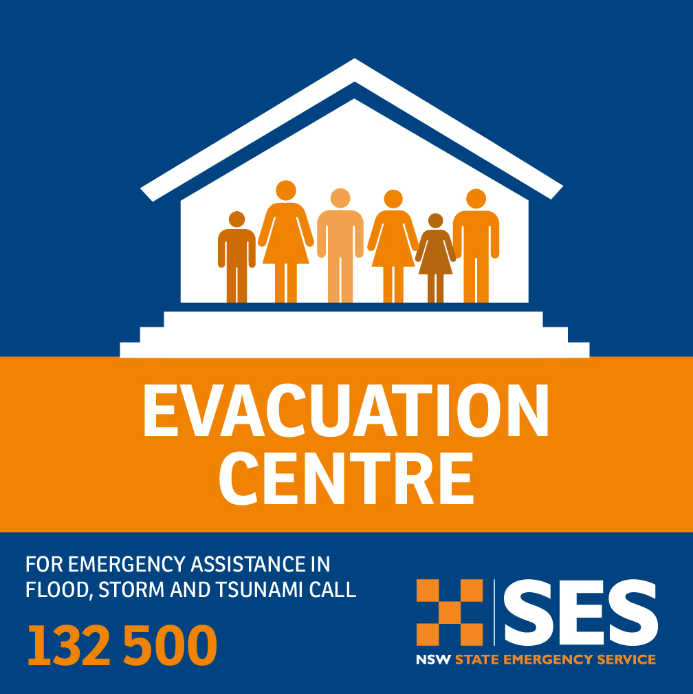
EVACUATION CENTRES
09/04/2024 06:30:33 AM
A list of all currently open evacuation centres.
HEAVY RAIN FALLS ALONG PARTS OF COAST, SES RESPOND TO MORE THAN 800 INCIDENTS.
05/04/2024 03:22:27 PM
The NSW State Emergency Service (SES) is advising people to stay indoors and avoid unnecessary travel as significant rainfall impacts much of the NSW east coast.
NSW SES WARNS OF SIGNIFICANT FLASH FLOODING RISK AS SEVERE WEATHER IMPACTS STATE
04/04/2024 04:32:13 PM
The NSW State Emergency Service (SES) has prepositioned assets and flood rescue teams as severe weather starts to impact parts of the state and a flood watch is issued for the Wilson’s River at Lismore.
PARTS OF NSW EAST COAST WARNED OF FLOOD RISK
03/04/2024 06:24:56 PM
Ahead of anticipated heavy rainfall, the NSW State Emergency Service (SES)...