Cold Snap Hits Eastern New South Wales
03/06/2019 09:05 AM
A Tasman Low will develop and rapidly deepen near the New South Wales southern coast today. A trough associated with this low will then surge northwards along the coast during the remainder of today and Tuesday, bringing strong to gale force southerly winds, high seas and much colder conditions.
Damaging surf conditions will develop about the far southern coast later this evening, extending north along the remainder of the coast during Tuesday, reaching Coffs Harbour and Byron Waters on Tuesday evening.
Damaging wind gusts will develop about the far southern coast later this evening, extending as far north as the Macquarie Waters by Tuesday afternoon, and possibly reaching the Coffs Harbour and Byron Waters later Tuesday. Damaging wind gusts may also affect high parts of the ranges adjacent to the coast. These conditions will begin to ease in the south during the latter part of Tuesday, and the remainder of the coast Wednesday morning
Blizzard conditions may develop about the Alps later today, continuing into early Tuesday, as winds potentially reach gale force in that region, bringing extremely cold weather and poor visibility. Moderate to locally heavy snow falls are expected about the Alps today, chiefly above 1000 metres. Generally lighter falls are expected further northwards along the ranges, possibly as low as 900 metres, and reaching the central ranges this afternoon or evening, and the northern ranges tonight.
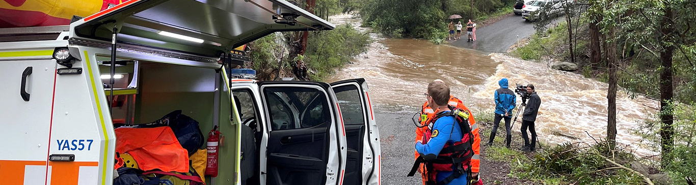
Heavy rainfall is not expected at this stage with this event. However, generally wet conditions with areas of rain are expected to develop in the state's far southeast by this evening, extending to central parts of the coast and adjacent ranges during Tuesday, and this may lead to plenty of water on the roads, to keep up-to-date with traffic by visiting Live Traffic
Currently there is a Severe Weather Warning for the East Coast of New South Wales. For more information regarding the weather and warnings please visit the Bureau of Meteorology
What you can do to prepare:
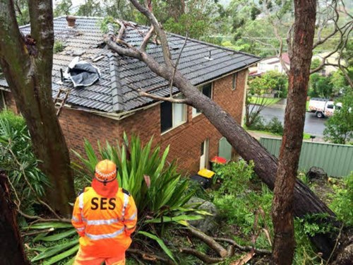
- Take the time this afternoon to move your car undercover and away from trees.
- Secure or put away loose items around your house, yard and balcony.
- Keep at least 8 metres away from fallen powerlines or objects that may be energised, such as fences.
For emergency help in flood and storm emergencies, please phone NSW SES on 132 500.
Learn more about When to Call NSW SES.
For up to date information follow us on Facebook and Twitter