Cold & Windy Weather, Be Prepared South Coast
11/05/2018 09:20 AM
The NSW State Emergency Service is asking people to be prepared for cold and windy weather over the next few days in the south and east of the State.
Winds may reach gale force with damaging gusts over parts of the state, particularly about the ranges and south coast. A Severe Weather Warning for damaging winds is current as at 9am Friday 11 May: Check current warnings
Light snow has been reported this morning from Oberon, Crookwell and Orange, with heavy snowfalls over the Alps and higher parts of the South West Slopes, and may be significant (10 cm or above) on the western side of the Divide as far north as the Central Tablelands.
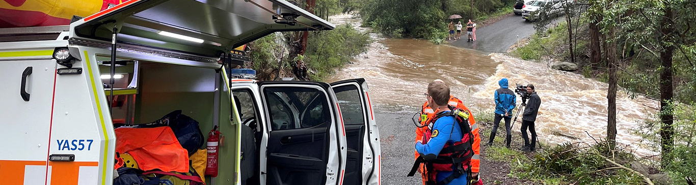
Hazardous or damaging surf is likely to develop from later tonight on the south coast and extend northwards during the weekend. In addition, a tidal surge is expected to raise the tide levels to well above what they would be otherwise.
Showers and isolate thunderstorms are expected in parts of the southern and central inland and later on the south coast, but rainfall is expected to be insufficient to cause flooding problems. Small hail is possible with thunderstorms.
The NSW SES recommends that residents in affected areas undertake the following actions to ensure they are prepared:
- Secure or put away loose items
- Check your roof is in good repair
- Put your car under cover and park away from trees
- Drive with care on mountain roads affected by snow and ice
Click here for more simple things you can do to prepare now for storms
For emergency help call the NSW SES on 132 500 or 000 if it is a life-threatening emergency.
Know when to call
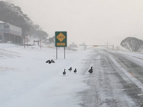
Picture: From Perisher Valley ski resort today.
For all the latest NSW SES news click here news